Bondowoso Regency
Kabupaten Bondowoso | |
|---|---|
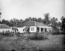 Assistant Resident Bondowoso in 1930 | |
 Coat of arms | |
| Motto: Swasthi Bhuwana Krta | |
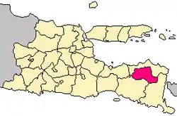 Location within East Java | |
| Coordinates: 7°56′25″S 113°59′00″E / 7.9404°S 113.9834°E | |
| Country | |
| Province | East Java |
| Capital | Bondowoso |
| Government | |
| • Regent | Amin Said Husni |
| • Vice Regent | Salwa Arifin |
| Area | |
| • Total | 1,518.77 km2 (586.40 sq mi) |
| Population (mid 2022 estimate)[1] | |
| • Total | 781,417 |
| • Density | 510/km2 (1,300/sq mi) |
| Time zone | UTC+7 (IWST) |
| Area code | (+62) 332 |
| Website | bondowosokab |

Bondowoso Regency is a landlocked regency in East Java, Indonesia.[2] It covers an area of 1,518.77 km2, and had a population of 736,772 at the 2010 Census[3] and 776,151 at the 2020 Census;[4] the official estimate as at mid 2022 was 781,417 (comprising 384,676 males and 396,741 females).[1] The most common languages are Madurese and Javanese, although Madurese is the majority. The nearest large city is Surabaya, approximately five hours' drive away.
The administrative centre of the regency is the provincial town of Bondowoso, after which the regency in named. Common in most provincial towns is a park in the city centre, called "Alun-Alun"; Bondowoso is no exception. In the backdrop of the park is a view of a mountain ("gunung").
Tourist spots include Kawah Ijen, a crater lake. Kawah Ijen is managed jointly by two local governments, Bondowoso Regency and Banyuwangi Regency.[5] In addition to the crater, other tourist destinations in Bondowoso are Tancak Kembar in Pakem and Air Terjun Belawan Sempol. A hike or climb to the crater takes around 1.5 to 3 hours. Other spots are Gunung Merapi and waterfalls.
Bondowoso town is known for its dessert, "tape" (pronounced "tah-peh"), to the extent that it is named "Tape city". Tape is tapioca with a kind of flour added that acts as a preservative. Medium-sized slices of tape are wrapped in banana leaves and kept in a light container for five days to be fermented prior to being consumed.
There is an Arabic community living in the area for some time, since before the Dutch occupation. They live in a place called "Kampung Arab" (Arabs Compound) on Imam Bonjol Street.
Administrative districts
The Regency is divided into twenty-three districts (kecamatan), tabulated below with their areas and their population totals from the 2010 Census[3] and the 2020 Census,[4] together with the official estimates as at mid 2022.[1] The former Sempol District, in the far southeast of the regency, which contains the crater lake of Kawah Ijen, has been renamed Ijen District; unlike the rest of the regency, which lies on the other side of the Ijen Mountain Range, it drains towards the Bali Strait. The table also includes the locations of the district headquarters and the number of administrative villages in each district (totaling 209 rural desa and 10 urban kelurahan), and its postcodes.
| Kode Wilayah | Name of District (kecamatan) | Area in km2 | Pop'n Census 2010 | Pop'n Census 2020 | Pop'n Estimate mid 2022 | Admin centre | No. of villages | Post codes |
|---|---|---|---|---|---|---|---|---|
| 35.11.01 | Maesan | 58.45 | 45,824 | 48,076 | 48,361 | Maesan | 12 | 68262 |
| 35.11.06 | Grujugan | 58.35 | 34,381 | 37,114 | 37,540 | Taman | 11 | 68261 |
| 35.11.02 | Tamanan | 30.87 | 35,621 | 38,414 | 38,848 | Tamanan | 9 | 68263 |
| 35.11.23 | Jambesari Darus Sholah | 27.62 | 33,723 | 36,086 | 36,439 | Jambesari | 9 | 68261 & 68263 (a) |
| 35.11.05 | Pujer | 38.33 | 37,600 | 40,226 | 40,167 | Kejayan | 11 | 68271 |
| 35.11.03 | Tlogosari | 109.68 | 44,033 | 45,704 | 45,879 | Pakisan | 10 | 68272 |
| 35.11.04 | Sukosari | 26.18 | 14,987 | 15,527 | 15,581 | Sukosari Lor | 4 | 68287 |
| 35.11.18 | Sumberwringin | 151.88 | 32,945 | 34,231 | 34,369 | Sumberwringin | 6 | 68289 |
| 35.11.10 | Tapen | 60.51 | 33,072 | 34,040 | 34,115 | Tapen | 9 | 68283 |
| 35.11.09 | Wonosari | 37.83 | 38,498 | 39,762 | 39,876 | Wonosari | 12 | 68282 |
| 35.11.08 | Tenggarang | 25.76 | 39,874 | 42,639 | 43,050 | Tenggarang | 12 (b) | 68281 |
| 35.11.11 | Bondowoso (town) | 22.84 | 70,963 | 76,422 | 77,263 | Dabasah | 11 (c) | 68211 - 68219 |
| 35.11.07 | Curahdami | 51.30 | 31,376 | 33,140 | 33,380 | Curahdami | 12 (b) | 68250 |
| 35.11.20 | Binakal | 39.10 | 15,173 | 17,030 | 17,356 | Binakal | 8 | 68251 |
| 35.11.17 | Pakem | 60.01 | 21,352 | 23,108 | 23,385 | Patemon | 8 | 68253 |
| 35.11.12 | Wringin | 55.18 | 39,423 | 40,076 | 40,068 | Wringin | 13 | 68252 |
| 35.11.13 | Tegalampel | 33.62 | 24,483 | 26,161 | 26,409 | Sekarputih | 8 (b) | 68292 |
| 35.11.21 | Taman Krocok | 44.57 | 16,237 | 16,711 | 16,748 | Taman Krocok | 7 | 68291 |
| 35.11.14 | Klabang | 74.93 | 18,413 | 18,378 | 18,316 | Klabang | 11 | 68284 |
| 35.11.19 | Ijen | 215.66 | 11,252 | 11,896 | 11,984 | Ijen | 6 | 68288 |
| 35.11.22 | Botolinggo | 126.82 | 28,801 | 29,937 | 30,060 | Lumutan | 8 | 68284 - 68285 |
| 35.11.16 | Prajekan | 52.77 | 25,116 | 25,581 | 25,585 | Prajekan Lor | 7 | 68285 |
| 35.11.15 | Cermee | 116.51 | 43,625 | 45,892 | 46,188 | Cernee | 15 | 68286 (d) |
| Totals | 1,518.77 | 736,772 | 776,151 | 781,417 | Bondowoso | 219 |
Notes: (a) except for the desa of Pengarang, which has a postcode of 68271. (b) including one kelurahan (the district administrative centre). (c) comprises 7 kelurahan (Badean, Blindungan, Dabasah, Kademangan, Kota Kulon, Nangkaan and Tamansari) and 4 desa. (d) except the desa of Grujugan, which has a postcode of 68261.
Megalithic artifacts
There are more than 1000 megalithic artifacts found in the villages around Bondowoso, such as menhirs (standing stones), sarcophagi, statues, dolmens (lying stones or tomb tables) and caves. A common megalith type found in Indonesia is the batu kenong with a shape resembling a local musical instrument. The Bondowoso Regency contains up to 400 batu kenong, the highest concentration in Indonesia. An easily accessible location with a wide variety of megaliths is the Pekauman Site at kilometer 8 on the Jember-Bondowoso road.[6]
Climate
Bondowoso has a tropical monsoon climate (Am) with moderate to little rainfall from May to October and heavy to very heavy rainfall from November to April.
| Climate data for Bondowoso | |||||||||||||
|---|---|---|---|---|---|---|---|---|---|---|---|---|---|
| Month | Jan | Feb | Mar | Apr | May | Jun | Jul | Aug | Sep | Oct | Nov | Dec | Year |
| Mean daily maximum °C (°F) | 30.1 (86.2) |
30.1 (86.2) |
30.2 (86.4) |
30.6 (87.1) |
30.3 (86.5) |
30.3 (86.5) |
30.2 (86.4) |
30.5 (86.9) |
31.7 (89.1) |
32.3 (90.1) |
31.7 (89.1) |
30.5 (86.9) |
30.7 (87.3) |
| Daily mean °C (°F) | 24.9 (76.8) |
24.9 (76.8) |
24.9 (76.8) |
25.1 (77.2) |
24.6 (76.3) |
24.2 (75.6) |
23.6 (74.5) |
23.9 (75.0) |
24.7 (76.5) |
25.3 (77.5) |
25.4 (77.7) |
24.9 (76.8) |
24.7 (76.5) |
| Mean daily minimum °C (°F) | 19.7 (67.5) |
19.7 (67.5) |
19.6 (67.3) |
19.6 (67.3) |
19.0 (66.2) |
18.1 (64.6) |
17.0 (62.6) |
17.3 (63.1) |
17.7 (63.9) |
18.4 (65.1) |
19.2 (66.6) |
19.4 (66.9) |
18.7 (65.7) |
| Average rainfall mm (inches) | 377 (14.8) |
333 (13.1) |
306 (12.0) |
168 (6.6) |
107 (4.2) |
42 (1.7) |
39 (1.5) |
27 (1.1) |
35 (1.4) |
87 (3.4) |
169 (6.7) |
295 (11.6) |
1,985 (78.1) |
| Source: Climate-Data.org[7] | |||||||||||||
See also
 Indonesia portal
- 64.25577279031161, -21.124882657270263 - well done
References
- 1 2 3 Badan Pusat Statistik, Jakarta, 2023, Kabupaten Bondowoso Dalam Angka 2023 (Katalog-BPS 1102001.3511)
- ↑ Witton, Patrick (2003). Indonesia (7th ed.). Melbourne: Lonely Planet. pp. 292–293, 294. ISBN 1-74059-154-2.
- 1 2 Biro Pusat Statistik, Jakarta, 2011.
- 1 2 Badan Pusat Statistik, Jakarta, 2021.
- ↑ bondowoso
- ↑ Alez Kurniawan (December 9, 2014). "In search of megaliths in Bondowoso".
- ↑ "Climate: Bondowoso". Climate-Data.org. Retrieved 15 November 2020.