Kediri Regency
Kabupaten Kediri | |
|---|---|
 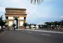 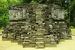 Clockwise, from top left : View of Mount Wilis and the Brantas River at Kediri, Surowono Temple, Simpang Lima Gumul Monument | |
|
Coat of arms | |
| Motto(s): Canda Bhirawa (forming the gallantry by the bond of unity) | |
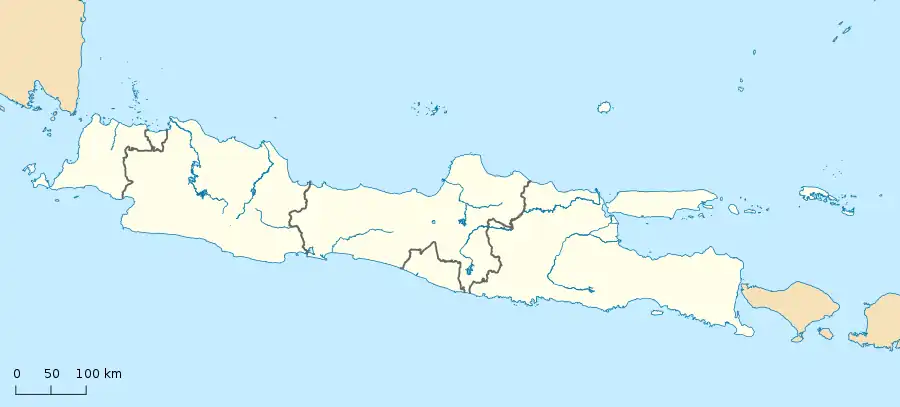
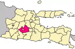 Location within East Java | |
| Coordinates: 7°50′00″S 112°10′00″E / 7.8333°S 112.1667°E | |
| Country | |
| Province | East Java |
| Capital | Ngasem |
| Government | |
| • Regent | Hanindhito Himawan Pramono |
| Area | |
| • Total | 1,563.42 km2 (603.64 sq mi) |
| Population (mid 2022 estimate)[1] | |
| • Total | 1,656,020 |
| • Density | 1,100/km2 (2,700/sq mi) |
| Time zone | UTC+7 (IWST) |
| Area code | (+62) 354 |
| Website | kedirikab.go.id |

Kediri Regency is a regency (kabupaten) located in East Java province, Indonesia. It is one of two 'Daerah Tingkat II' that has the name 'Kediri' (the other is the City of Kediri, which is separate from the Regency). The Regency covers an area of 1,523.92 km2 and had a population of 1,499,768 as of the 2010 census[2] and 1,635,294 at the 2020 census;[3] the official estimate as at mid 2022 was 1,656,020 (comprising 836,025 males and 819,995 females).[1]
The capital of the regency is at the town of Ngasem, near to the border of Kediri city, just about 200 m. However, several regency government establishments are also located within Kediri city, administratively a separate political entity. This is because both the regency and the city share common cultural and historical roots, and the administrative division occurred only after the War of Independence. The regency shares borders with Jombang Regency to the north, Malang Regency to the east, Blitar Regency and Tulungagung Regency to the south, and Nganjuk Regency to the west, while Kediri city is wholly surrounded within the Regency. Kelud mountain, one of the most active volcanoes in Indonesia, is partially administered by the Government of Kediri Regency (along with Blitar Regency).
The regency also contains the famed "Kampung Inggris", or English Village. Kampung Inggris is a small area in the district of Pare where over a hundred businesses offering various English courses are clustered. Students come from all over Indonesia to take courses in the English Village, where it is common for people to speak with each other in English (rather than Indonesian or Javanese) for the sake of practice.
Administrative districts
The regency is divided into twenty-six districts (kecamatan), listed below with their areas and their populations at the 2010 census[2] and the 2020 census,[3] together with the official estimates as at mid 2022.[1] The table also includes the locations of the district administrative centres, the numbers of administrative villages in each district (totaling 343 rural desa and a single urban kelurahan - Pare kelurahan in the district of the same name), and its post code(s).
| Kode Wilayah | Name of District (kecamatan) | Area in km2 | Pop'n census 2010 | Pop'n census 2020 | Pop'n estimate mid 2022 | Admin centre | No. of villages | Post code |
|---|---|---|---|---|---|---|---|---|
| 35.06.02 | Mojo | 149.95 | 73,475 | 79,617 | 80,512 | Mojo | 20 | 64162 |
| 35.06.01 | Semen | 68.10 | 50,273 | 54,742 | 55,407 | Semen | 12 | 64161 |
| 35.06.04 | Ngadiluwih | 45.06 | 73,573 | 80,024 | 80,979 | Purwokerto | 16 | 64171 |
| 35.06.03 | Kras | 50.44 | 56,526 | 62,616 | 63,588 | Kras | 16 | 64172 |
| 35.06.23 | Ringinrejo | 45.18 | 50,005 | 56,906 | 58,091 | Ringinrejo | 11 | 64176 |
| 35.06.05 | Kandat | 55.12 | 56,160 | 62,281 | 63,261 | Kandat | 12 | 64173 (a) |
| 35.06.06 | Wates | 73.71 | 83,625 | 90,772 | 91,819 | Wates | 18 | 64174 |
| 35.06.07 | Ngancar | 101.31 | 45,035 | 50,413 | 51,299 | Ngancar | 10 | 64291 (b) |
| 35.06.09 | Plosoklaten | 105.18 | 67,446 | 74,284 | 75,353 | Ploso Lor | 15 | 64175 |
| 35.06.10 | Gurah | 58.53 | 77,185 | 82,573 | 83,291 | Gurah | 21 | 64181 (c) |
| 35.06.08 | Puncu | 114.06 | 58,354 | 63,659 | 64,456 | Puncu | 8 | 64292 |
| 35.06.18 | Kepung | 91.05 | 80,682 | 85,440 | 86,013 | Kepung | 10 | 64293 |
| 35.06.19 | Kandangan | 60.40 | 47,070 | 51,683 | 52,395 | Kandangan | 12 | 64294 |
| 35.06.17 | Pare | 52.27 | 98,594 | 106,007 | 107,032 | Pare | 9 | 64211 - 64215, 64225 - 64229 |
| 35.06.26 | Badas | 42.92 | 59,319 | 67,286 | 68,644 | Badas | 8 | 64216 - 64224 |
| 35.06.21 | Kunjang | 31.46 | 33,731 | 36,765 | 37,219 | Kapi | 12 | 64156 |
| 35.06.16 | Plemahan | 55.36 | 55,888 | 60,655 | 61,353 | Bogo Kidul | 17 | 64155 |
| 35.06.15 | Purwoasri | 47.10 | 54,431 | 58,965 | 59,622 | Purwoasri | 23 | 64154 |
| 35.06.14 | Papar | 40.16 | 48,593 | 52,400 | 52,937 | Papar | 17 | 65153 |
| 35.06.11 | Pagu | 28.12 | 36,766 | 40,178 | 40,694 | Sitimerto | 13 | 64184 |
| 35.06.24 | Kayen Kidul | 38.47 | 43,422 | 47,150 | 47,697 | Kayen Kidul | 12 | 64183 |
| 35.06.12 | Gampengrejo | 19.99 | 31,964 | 35,528 | 36,103 | Gampeng | 11 | 64182 |
| 35.06.25 | Ngasem | 23.45 | 62,061 | 66,974 | 67,670 | Ngasem | 12 | 64181 |
| 35.06.22 | Banyakan | 74.22 | 54,175 | 58,525 | 59,511 | Banyakan | 9 | 64157 |
| 35.06.13 | Grogol | 41.94 | 44,468 | 47,528 | 47,932 | Grogol | 9 | 64151 |
| 35.06.20 | Tarokan | 49.61 | 56,947 | 62,323 | 63,142 | Tarokan | 10 | 64152 |
| Totals | 1,563.42 | 1,499,768 | 1,635,294 | 1,656,020 | Ngasem | 344 |
Notes: (a) except the village of Ngletih, which has a postcode of 64137. (b) except the village of Kunjang, which has a postcode of 64156. (c) except the village of Gatam, which has a postcode of 64113.
Tourist attractions
- Simpang Lima Gumul Monument
- Gunung Kelud
- Air Terjun Dolo
- Air Terjun Irenggolo