Cayres | |
|---|---|
Commune | |
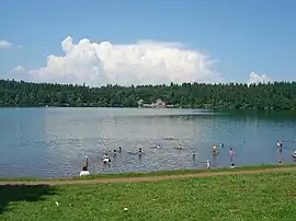 Beach at Lake Bouchet, with restaurant on the far side | |
 Coat of arms | |
Location of Cayres | |
 Cayres  Cayres | |
| Coordinates: 44°55′35″N 3°48′28″E / 44.9264°N 3.8078°E | |
| Country | France |
| Region | Auvergne-Rhône-Alpes |
| Department | Haute-Loire |
| Arrondissement | Le Puy-en-Velay |
| Canton | Velay volcanique |
| Intercommunality | Pays de Cayres et de Pradelles |
| Government | |
| • Mayor (2020–2026) | Ludovic Gire[1] |
| Area 1 | 29.22 km2 (11.28 sq mi) |
| Population | 696 |
| • Density | 24/km2 (62/sq mi) |
| Time zone | UTC+01:00 (CET) |
| • Summer (DST) | UTC+02:00 (CEST) |
| INSEE/Postal code | 43042 /43510 |
| Elevation | 971–1,382 m (3,186–4,534 ft) (avg. 1,180 m or 3,870 ft) |
| 1 French Land Register data, which excludes lakes, ponds, glaciers > 1 km2 (0.386 sq mi or 247 acres) and river estuaries. | |
Cayres (French pronunciation: [kɛʁ]; Occitan: Caires) is a commune in the Haute-Loire department and Auvergne-Rhône-Alpes region of southeast central France.
Population
| Year | Pop. | ±% p.a. |
|---|---|---|
| 1968 | 699 | — |
| 1975 | 614 | −1.84% |
| 1982 | 589 | −0.59% |
| 1990 | 511 | −1.76% |
| 1999 | 613 | +2.04% |
| 2009 | 711 | +1.49% |
| 2014 | 720 | +0.25% |
| 2020 | 700 | −0.47% |
| Source: INSEE[3] | ||
See also
References
- ↑ "Répertoire national des élus: les maires" (in French). data.gouv.fr, Plateforme ouverte des données publiques françaises. 13 September 2022.
- ↑ "Populations légales 2021". The National Institute of Statistics and Economic Studies. 28 December 2023.
- ↑ Population en historique depuis 1968, INSEE
Wikimedia Commons has media related to Cayres.
This article is issued from Wikipedia. The text is licensed under Creative Commons - Attribution - Sharealike. Additional terms may apply for the media files.