Esplantas-Vazeilles | |
|---|---|
Commune | |
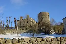 Chateau of Esplantas | |
Location of Esplantas-Vazeilles | |
 Esplantas-Vazeilles  Esplantas-Vazeilles | |
| Coordinates: 44°54′29″N 3°32′49″E / 44.908°N 3.547°E | |
| Country | France |
| Region | Auvergne-Rhône-Alpes |
| Department | Haute-Loire |
| Arrondissement | Brioude |
| Canton | Gorges de l'Allier-Gévaudan |
| Government | |
| • Mayor (2020–2026) | Thierry Astruc[1] |
| Area 1 | 17.13 km2 (6.61 sq mi) |
| Population | 126 |
| • Density | 7.4/km2 (19/sq mi) |
| Time zone | UTC+01:00 (CET) |
| • Summer (DST) | UTC+02:00 (CEST) |
| INSEE/Postal code | 43090 /43170 |
| Elevation | 894–1,154 m (2,933–3,786 ft) |
| 1 French Land Register data, which excludes lakes, ponds, glaciers > 1 km2 (0.386 sq mi or 247 acres) and river estuaries. | |
Esplantas-Vazeilles is a commune in the Haute-Loire department in south-central France. The municipality was established on 1 January 2016 and consists of the former communes of Esplantas and Vazeilles-près-Saugues.[3]
Population
| Year | Pop. | ±% p.a. |
|---|---|---|
| 1968 | 292 | — |
| 1975 | 232 | −3.23% |
| 1982 | 187 | −3.03% |
| 1990 | 151 | −2.64% |
| 1999 | 139 | −0.92% |
| 2007 | 146 | +0.62% |
| 2012 | 139 | −0.98% |
| 2017 | 126 | −1.94% |
| Populations of the area corresponding with the commune of Esplantas-Vazeilles at 1 January 2020. Source: INSEE[4] | ||
See also
References
- ↑ "Répertoire national des élus: les maires" (in French). data.gouv.fr, Plateforme ouverte des données publiques françaises. 13 September 2022.
- ↑ "Populations légales 2021". The National Institute of Statistics and Economic Studies. 28 December 2023.
- ↑ Arrêté préfectoral 18 December 2015 (in French)
- ↑ Population en historique depuis 1968, INSEE
Wikimedia Commons has media related to Esplantas-Vazeilles.
This article is issued from Wikipedia. The text is licensed under Creative Commons - Attribution - Sharealike. Additional terms may apply for the media files.