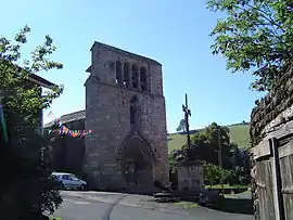
Saint-Martin-de-Fugères | |
|---|---|
Commune | |
 | |
Location of Saint-Martin-de-Fugères | |
 Saint-Martin-de-Fugères  Saint-Martin-de-Fugères | |
| Coordinates: 44°54′24″N 3°56′07″E / 44.9067°N 3.9353°E | |
| Country | France |
| Region | Auvergne-Rhône-Alpes |
| Department | Haute-Loire |
| Arrondissement | Le Puy-en-Velay |
| Canton | Mézenc |
| Government | |
| • Mayor (2020–2026) | Jean-Pierre Pons[1] |
| Area 1 | 20.87 km2 (8.06 sq mi) |
| Population | 231 |
| • Density | 11/km2 (29/sq mi) |
| Time zone | UTC+01:00 (CET) |
| • Summer (DST) | UTC+02:00 (CEST) |
| INSEE/Postal code | 43210 /43150 |
| Elevation | 725–1,185 m (2,379–3,888 ft) (avg. 1,003 m or 3,291 ft) |
| 1 French Land Register data, which excludes lakes, ponds, glaciers > 1 km2 (0.386 sq mi or 247 acres) and river estuaries. | |
Saint-Martin-de-Fugères (French pronunciation: [sɛ̃ maʁtɛ̃ də fyʒɛʁ]) is a commune in the Haute-Loire department in south-central France.[3]
Population
| Year | Pop. | ±% p.a. |
|---|---|---|
| 1968 | 512 | — |
| 1975 | 422 | −2.72% |
| 1982 | 363 | −2.13% |
| 1990 | 266 | −3.81% |
| 1999 | 245 | −0.91% |
| 2009 | 216 | −1.25% |
| 2014 | 211 | −0.47% |
| 2020 | 236 | +1.88% |
| Source: INSEE[4] | ||
Sights
The Robert Louis Stevenson Trail (GR 70), a popular long-distance path, runs through the village.[5]
See also
References
- ↑ "Répertoire national des élus: les maires". data.gouv.fr, Plateforme ouverte des données publiques françaises (in French). 2 December 2020.
- ↑ "Populations légales 2021". The National Institute of Statistics and Economic Studies. 28 December 2023.
- ↑ INSEE commune file
- ↑ Population en historique depuis 1968, INSEE
- ↑ Castle, Alan (2007). The Robert Louis Stevenson Trail (2nd ed.). Cicerone. pp. 63–64. ISBN 978-1-85284-511-7.
Wikimedia Commons has media related to Saint-Martin-de-Fugères.
This article is issued from Wikipedia. The text is licensed under Creative Commons - Attribution - Sharealike. Additional terms may apply for the media files.