Saint-Paul-de-Tartas | |
|---|---|
Commune | |
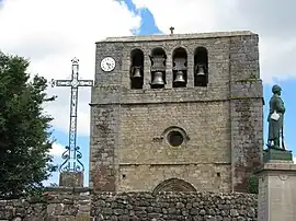 Bell tower | |
.svg.png.webp) Coat of arms | |
Location of Saint-Paul-de-Tartas | |
 Saint-Paul-de-Tartas  Saint-Paul-de-Tartas | |
| Coordinates: 44°48′16″N 3°54′27″E / 44.8044°N 3.9075°E | |
| Country | France |
| Region | Auvergne-Rhône-Alpes |
| Department | Haute-Loire |
| Arrondissement | Le Puy-en-Velay |
| Canton | Velay volcanique |
| Intercommunality | Pays de Cayres et de Pradelles |
| Government | |
| • Mayor (2020–2026) | Marie-Laure Mugnier[1] |
| Area 1 | 27.47 km2 (10.61 sq mi) |
| Population | 182 |
| • Density | 6.6/km2 (17/sq mi) |
| Time zone | UTC+01:00 (CET) |
| • Summer (DST) | UTC+02:00 (CEST) |
| INSEE/Postal code | 43215 /43420 |
| Elevation | 933–1,342 m (3,061–4,403 ft) (avg. 1,200 m or 3,900 ft) |
| 1 French Land Register data, which excludes lakes, ponds, glaciers > 1 km2 (0.386 sq mi or 247 acres) and river estuaries. | |
Saint-Paul-de-Tartas (French pronunciation: [sɛ̃ pɔl də taʁtas]) is a commune in the Haute-Loire department in south-central France.[3]
Population
| Year | Pop. | ±% p.a. |
|---|---|---|
| 1968 | 514 | — |
| 1975 | 415 | −3.01% |
| 1982 | 341 | −2.77% |
| 1990 | 270 | −2.88% |
| 1999 | 244 | −1.12% |
| 2009 | 191 | −2.42% |
| 2014 | 207 | +1.62% |
| 2020 | 184 | −1.94% |
| Source: INSEE[4] | ||
See also
References
- ↑ "Répertoire national des élus: les maires". data.gouv.fr, Plateforme ouverte des données publiques françaises (in French). 9 August 2021.
- ↑ "Populations légales 2021". The National Institute of Statistics and Economic Studies. 28 December 2023.
- ↑ INSEE commune file
- ↑ Population en historique depuis 1968, INSEE
Wikimedia Commons has media related to Saint-Paul-de-Tartas.
This article is issued from Wikipedia. The text is licensed under Creative Commons - Attribution - Sharealike. Additional terms may apply for the media files.