Cernay-l'Église | |
|---|---|
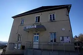 The town hall in Cernay-l'Église | |
Location of Cernay-l'Église | |
 Cernay-l'Église  Cernay-l'Église | |
| Coordinates: 47°15′28″N 6°49′54″E / 47.2578°N 6.8317°E | |
| Country | France |
| Region | Bourgogne-Franche-Comté |
| Department | Doubs |
| Arrondissement | Montbéliard |
| Canton | Maîche |
| Government | |
| • Mayor (2020–2026) | Gérard Gentit[1] |
| Area 1 | 5.95 km2 (2.30 sq mi) |
| Population | 315 |
| • Density | 53/km2 (140/sq mi) |
| Time zone | UTC+01:00 (CET) |
| • Summer (DST) | UTC+02:00 (CEST) |
| INSEE/Postal code | 25108 /25120 |
| Elevation | 787–982 m (2,582–3,222 ft) |
| 1 French Land Register data, which excludes lakes, ponds, glaciers > 1 km2 (0.386 sq mi or 247 acres) and river estuaries. | |
Cernay-l'Église (French pronunciation: [sɛʁnɛ leɡliz]) is a commune in the Doubs department in the Bourgogne-Franche-Comté region in eastern France.
Population
| Year | Pop. | ±% |
|---|---|---|
| 1962 | 109 | — |
| 1968 | 117 | +7.3% |
| 1975 | 154 | +31.6% |
| 1982 | 225 | +46.1% |
| 1990 | 232 | +3.1% |
| 1999 | 258 | +11.2% |
| 2008 | 252 | −2.3% |
| 2012 | 290 | +15.1% |
See also
References
- ↑ "Répertoire national des élus: les maires" (in French). data.gouv.fr, Plateforme ouverte des données publiques françaises. 13 September 2022.
- ↑ "Populations légales 2021". The National Institute of Statistics and Economic Studies. 28 December 2023.
Wikimedia Commons has media related to Cernay-l'Église.
This article is issued from Wikipedia. The text is licensed under Creative Commons - Attribution - Sharealike. Additional terms may apply for the media files.