Pierrefontaine-lès-Blamont | |
|---|---|
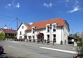 The town hall in Pierrefontaine-lès-Blamont | |
 Coat of arms | |
Location of Pierrefontaine-lès-Blamont | |
 Pierrefontaine-lès-Blamont  Pierrefontaine-lès-Blamont | |
| Coordinates: 47°22′35″N 6°50′23″E / 47.3764°N 6.8397°E | |
| Country | France |
| Region | Bourgogne-Franche-Comté |
| Department | Doubs |
| Arrondissement | Montbéliard |
| Canton | Maîche |
| Intercommunality | Pays de Montbéliard Agglomération |
| Government | |
| • Mayor (2020–2026) | Catherine Meunier[1] |
| Area 1 | 8.96 km2 (3.46 sq mi) |
| Population | 477 |
| • Density | 53/km2 (140/sq mi) |
| Time zone | UTC+01:00 (CET) |
| • Summer (DST) | UTC+02:00 (CEST) |
| INSEE/Postal code | 25452 /25310 |
| Elevation | 490–835 m (1,608–2,740 ft) |
| 1 French Land Register data, which excludes lakes, ponds, glaciers > 1 km2 (0.386 sq mi or 247 acres) and river estuaries. | |
Pierrefontaine-lès-Blamont (French pronunciation: [pjɛʁfɔ̃tɛn lɛ blamɔ̃], literally Pierrefontaine near Blamont) is a commune in the Doubs department in the Bourgogne-Franche-Comté region in eastern France.
Population
| Year | Pop. | ±% |
|---|---|---|
| 1962 | 174 | — |
| 1968 | 201 | +15.5% |
| 1975 | 190 | −5.5% |
| 1982 | 190 | +0.0% |
| 1990 | 235 | +23.7% |
| 1999 | 304 | +29.4% |
| 2008 | 393 | +29.3% |
| 2012 | 405 | +3.1% |
See also
References
- ↑ "Répertoire national des élus: les maires". data.gouv.fr, Plateforme ouverte des données publiques françaises (in French). 2 December 2020.
- ↑ "Populations légales 2021". The National Institute of Statistics and Economic Studies. 28 December 2023.
Wikimedia Commons has media related to Pierrefontaine-lès-Blamont.
This article is issued from Wikipedia. The text is licensed under Creative Commons - Attribution - Sharealike. Additional terms may apply for the media files.