Rurey | |
|---|---|
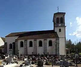 The church in Rurey | |
Location of Rurey | |
 Rurey  Rurey | |
| Coordinates: 47°05′50″N 6°00′35″E / 47.0972°N 6.0097°E | |
| Country | France |
| Region | Bourgogne-Franche-Comté |
| Department | Doubs |
| Arrondissement | Besançon |
| Canton | Saint-Vit |
| Intercommunality | Loue-Lison |
| Government | |
| • Mayor (2020–2026) | Alain Monnier[1] |
| Area 1 | 14.77 km2 (5.70 sq mi) |
| Population | 357 |
| • Density | 24/km2 (63/sq mi) |
| Time zone | UTC+01:00 (CET) |
| • Summer (DST) | UTC+02:00 (CEST) |
| INSEE/Postal code | 25511 /25290 |
| Elevation | 285–520 m (935–1,706 ft) |
| 1 French Land Register data, which excludes lakes, ponds, glaciers > 1 km2 (0.386 sq mi or 247 acres) and river estuaries. | |
Rurey (French pronunciation: [ʁyʁɛ]) is a commune in the Doubs department in the Bourgogne-Franche-Comté region in eastern France.
Geography
Rurey lies 14 km (8.7 mi) east of Quingey in the valley of the Loue between Ornans and Quingey.
Population
| Year | Pop. | ±% |
|---|---|---|
| 1962 | 167 | — |
| 1968 | 183 | +9.6% |
| 1975 | 154 | −15.8% |
| 1982 | 189 | +22.7% |
| 1990 | 227 | +20.1% |
| 1999 | 282 | +24.2% |
| 2008 | 319 | +13.1% |
| 2012 | 327 | +2.5% |
See also
References
- ↑ "Répertoire national des élus: les maires". data.gouv.fr, Plateforme ouverte des données publiques françaises (in French). 9 August 2021.
- ↑ "Populations légales 2021". The National Institute of Statistics and Economic Studies. 28 December 2023.
External links
Wikimedia Commons has media related to Rurey.
- Rurey on the regional Web site (in French)
This article is issued from Wikipedia. The text is licensed under Creative Commons - Attribution - Sharealike. Additional terms may apply for the media files.