Les Alliés | |
|---|---|
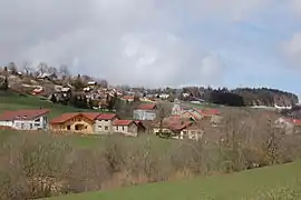 A general view of Les Alliés | |
Location of Les Alliés | |
 Les Alliés  Les Alliés | |
| Coordinates: 46°56′56″N 6°26′54″E / 46.9489°N 6.4483°E | |
| Country | France |
| Region | Bourgogne-Franche-Comté |
| Department | Doubs |
| Arrondissement | Pontarlier |
| Canton | Ornans |
| Intercommunality | Montbenoît |
| Government | |
| • Mayor (2022–2026) | Pierre Millon[1] |
| Area 1 | 5.28 km2 (2.04 sq mi) |
| Population | 171 |
| • Density | 32/km2 (84/sq mi) |
| Time zone | UTC+01:00 (CET) |
| • Summer (DST) | UTC+02:00 (CEST) |
| INSEE/Postal code | 25012 /25300 |
| Elevation | 943–1,171 m (3,094–3,842 ft) |
| 1 French Land Register data, which excludes lakes, ponds, glaciers > 1 km2 (0.386 sq mi or 247 acres) and river estuaries. | |
Les Alliés (French pronunciation: [le.z‿alje]) is a commune in the Doubs department in the Bourgogne-Franche-Comté region in eastern France.
Population
| Year | Pop. | ±% p.a. |
|---|---|---|
| 1968 | 61 | — |
| 1975 | 67 | +1.35% |
| 1982 | 63 | −0.88% |
| 1990 | 56 | −1.46% |
| 1999 | 103 | +7.01% |
| 2009 | 107 | +0.38% |
| 2014 | 133 | +4.45% |
| 2020 | 170 | +4.18% |
| Source: INSEE[3] | ||
See also
References
- ↑ "Répertoire national des élus: les maires" (in French). data.gouv.fr, Plateforme ouverte des données publiques françaises. 13 September 2022.
- ↑ "Populations légales 2021". The National Institute of Statistics and Economic Studies. 28 December 2023.
- ↑ Population en historique depuis 1968, INSEE
Wikimedia Commons has media related to Les Alliés.
This article is issued from Wikipedia. The text is licensed under Creative Commons - Attribution - Sharealike. Additional terms may apply for the media files.