Cestayrols | |
|---|---|
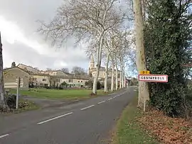 The road into Cestayrols | |
.svg.png.webp) Coat of arms | |
Location of Cestayrols | |
 Cestayrols  Cestayrols | |
| Coordinates: 43°58′52″N 1°59′07″E / 43.9811°N 1.9853°E | |
| Country | France |
| Region | Occitania |
| Department | Tarn |
| Arrondissement | Albi |
| Canton | Les Deux Rives |
| Intercommunality | CA Gaillac-Graulhet |
| Area 1 | 17.03 km2 (6.58 sq mi) |
| Population | 466 |
| • Density | 27/km2 (71/sq mi) |
| Time zone | UTC+01:00 (CET) |
| • Summer (DST) | UTC+02:00 (CEST) |
| INSEE/Postal code | 81067 /81150 |
| Elevation | 188–282 m (617–925 ft) (avg. 240 m or 790 ft) |
| 1 French Land Register data, which excludes lakes, ponds, glaciers > 1 km2 (0.386 sq mi or 247 acres) and river estuaries. | |
Cestayrols is a commune in the Tarn department in southern France.
Geography
The Vère flows southwestward through the northern part of the commune.
See also
References
- ↑ "Populations légales 2021". The National Institute of Statistics and Economic Studies. 28 December 2023.
Wikimedia Commons has media related to Cestayrols.
This article is issued from Wikipedia. The text is licensed under Creative Commons - Attribution - Sharealike. Additional terms may apply for the media files.