Saint-Benoît-de-Carmaux | |
|---|---|
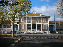 The school in Saint-Benoît-de-Carmaux | |
.svg.png.webp) Coat of arms | |
Location of Saint-Benoît-de-Carmaux | |
 Saint-Benoît-de-Carmaux  Saint-Benoît-de-Carmaux | |
| Coordinates: 44°03′11″N 2°07′50″E / 44.0531°N 2.1306°E | |
| Country | France |
| Region | Occitania |
| Department | Tarn |
| Arrondissement | Albi |
| Canton | Carmaux-2 Vallée du Cérou |
| Intercommunality | Carmausin-Ségala |
| Government | |
| • Mayor (2020–2026) | Thierry San Andrès[1] |
| Area 1 | 4.49 km2 (1.73 sq mi) |
| Population | 2,059 |
| • Density | 460/km2 (1,200/sq mi) |
| Time zone | UTC+01:00 (CET) |
| • Summer (DST) | UTC+02:00 (CEST) |
| INSEE/Postal code | 81244 /81400 |
| Elevation | 217–330 m (712–1,083 ft) (avg. 285 m or 935 ft) |
| 1 French Land Register data, which excludes lakes, ponds, glaciers > 1 km2 (0.386 sq mi or 247 acres) and river estuaries. | |
Saint-Benoît-de-Carmaux (French pronunciation: [sɛ̃ bənwa də kaʁmo], literally Saint-Benoît of Carmaux; Languedocien: Sant Benesech de Carmauç) is a commune in the Tarn department in southern France.
Geography
The commune is traversed by the Cérou river.
Population
| Year | Pop. | ±% p.a. |
|---|---|---|
| 1968 | 3,579 | — |
| 1975 | 3,171 | −1.71% |
| 1982 | 2,745 | −2.04% |
| 1990 | 2,431 | −1.51% |
| 1999 | 2,265 | −0.78% |
| 2007 | 2,131 | −0.76% |
| 2012 | 2,164 | +0.31% |
| 2017 | 2,165 | +0.01% |
| Source: INSEE[3] | ||
See also
References
- ↑ "Répertoire national des élus: les maires" (in French). data.gouv.fr, Plateforme ouverte des données publiques françaises. 13 September 2022.
- ↑ "Populations légales 2021". The National Institute of Statistics and Economic Studies. 28 December 2023.
- ↑ Population en historique depuis 1968, INSEE
Wikimedia Commons has media related to Saint-Benoît-de-Carmaux.
This article is issued from Wikipedia. The text is licensed under Creative Commons - Attribution - Sharealike. Additional terms may apply for the media files.