Dolní Dubňany | |
|---|---|
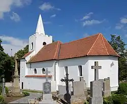 Church of Saint Wenceslaus | |
 Flag  Coat of arms | |
 Dolní Dubňany Location in the Czech Republic | |
| Coordinates: 49°3′21″N 16°13′36″E / 49.05583°N 16.22667°E | |
| Country | |
| Region | South Moravian |
| District | Znojmo |
| First mentioned | 1351 |
| Area | |
| • Total | 8.12 km2 (3.14 sq mi) |
| Elevation | 309 m (1,014 ft) |
| Population (2023-01-01)[1] | |
| • Total | 475 |
| • Density | 58/km2 (150/sq mi) |
| Time zone | UTC+1 (CET) |
| • Summer (DST) | UTC+2 (CEST) |
| Postal code | 671 73 |
| Website | www |
Dolní Dubňany is a municipality and village in Znojmo District in the South Moravian Region of the Czech Republic. It has about 500 inhabitants.
Dolní Dubňany lies approximately 27 kilometres (17 mi) north-east of Znojmo, 33 km (21 mi) south-west of Brno, and 174 km (108 mi) south-east of Prague.
References
Wikimedia Commons has media related to Dolní Dubňany.
This article is issued from Wikipedia. The text is licensed under Creative Commons - Attribution - Sharealike. Additional terms may apply for the media files.