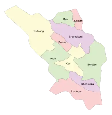
Farsan County
Persian: شهرستان فارسان | |
|---|---|
County | |
 Location of Farsan County in Chaharmahal and Bakhtiari province (center, pink) | |
 Location of Chaharmahal and Bakhtiari province in Iran | |
| Coordinates: 32°13′N 50°35′E / 32.217°N 50.583°E[1] | |
| Country | |
| Province | Chaharmahal and Bakhtiari |
| Capital | Farsan |
| Districts | Central, Babaheydar, Junqan |
| Population (2016) | |
| • Total | 95,286 |
| Time zone | UTC+3:30 (IRST) |
| Farsan County can be found at GEOnet Names Server, at this link, by opening the Advanced Search box, entering "9206271" in the "Unique Feature Id" form, and clicking on "Search Database". | |
Farsan County (Persian: شهرستان فارسان) is in Chaharmahal and Bakhtiari province, Iran. Its capital is the city of Farsan.[2]
At the 2006 census, the county's population was 90,111 in 19,878 households.[3] The following census in 2011 counted 93,941 people in 24,747 households.[4] At the 2016 census the county's population was 95,286, in 26,914 households.[5]
Administrative divisions
The population history and structural changes of Farsan County's administrative divisions over three consecutive censuses are shown in the following table. The latest census shows three districts, five rural districts, and six cities.[5]
After the census, the village of Filabad was elevated to the status of a city.[6]
| Administrative Divisions | 2006[3] | 2011[4] | 2016[5] |
|---|---|---|---|
| Central District | 90,111 | 50,005 | 41,493 |
| Mizdej-e Olya RD | 14,366 | 10,893 | 4,810 |
| Mizdej-e Sofla RD | 23,944 | ||
| Babaheydar (city) | 10,922 | 11,099 | |
| Farsan (city) | 26,219 | 28,013 | 30,504 |
| Gujan (city) | 6,179 | ||
| Junqan (city) | 14,660 | ||
| Babaheydar District | 8,770 | 18,917 | |
| Sarab-e Olya RD | 1,623 | 1,302 | |
| Sarab-e Sofla RD | 7,147 | 6,413 | |
| Babaheydar (city) | 11,202 | ||
| Filabad (city)1 | |||
| Junqan District | 35,166 | 34,876 | |
| Junqan RD | 1,225 | 2,750 | |
| Mizdej-e Sofla RD | 11,053 | 4,049 | |
| Cholicheh (city) | 4,945 | ||
| Junqan (city) | 14,800 | 14,433 | |
| Pardanjan (city) | 8,088 | 8,699 | |
| Total | 90,111 | 93,941 | 95,286 |
| RD: Rural District 1Became a city after the 2016 census[6] | |||
Wikimedia Commons has media related to Farsan County.
References
- ↑ OpenStreetMap contributors (1 April 2023). "Farsan County" (Map). OpenStreetMap. Retrieved 1 April 2023.
- ↑ Habibi, Hassan (21 June 1369). "Approval of the organization and chain of citizenship of the elements and units of the national divisions of Chaharmahal and Bakhtiari province, centered in the city of Shahrekord". Islamic Parliament Research Center (in Persian). Ministry of Interior, Defense Political Commission of the Government Board. Archived from the original on 21 September 2016. Retrieved 2 December 2023.
- 1 2 "Census of the Islamic Republic of Iran, 1385 (2006)". AMAR (in Persian). The Statistical Center of Iran. p. 14. Archived from the original (Excel) on 20 September 2011. Retrieved 25 September 2022.
- 1 2 "Census of the Islamic Republic of Iran, 1390 (2011)". Syracuse University (in Persian). The Statistical Center of Iran. p. 14. Archived from the original (Excel) on 16 January 2023. Retrieved 19 December 2022.
- 1 2 3 "Census of the Islamic Republic of Iran, 1395 (2016)". AMAR (in Persian). The Statistical Center of Iran. p. 14. Archived from the original (Excel) on 24 May 2019. Retrieved 19 December 2022.
- 1 2 Heydari, Gholam Ali (9 December 2017). "Deputy Governor of Chaharmahal and Bakhtiari: Filabad, Farsan County, became a city". Ostan-CHB (in Persian). Ministry of Interior. Archived from the original on 1 April 2023. Retrieved 1 April 2023.
| Capital |  | ||||||||||||||||||||||
|---|---|---|---|---|---|---|---|---|---|---|---|---|---|---|---|---|---|---|---|---|---|---|---|
| Counties and cities |
| ||||||||||||||||||||||
| Landmarks |
| ||||||||||||||||||||||
| populated places | |||||||||||||||||||||||
| Capital | |||||||||||
|---|---|---|---|---|---|---|---|---|---|---|---|
| Districts |
| ||||||||||
This article is issued from Wikipedia. The text is licensed under Creative Commons - Attribution - Sharealike. Additional terms may apply for the media files.