Folwell | |
|---|---|
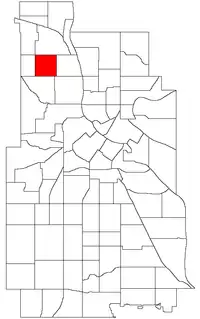 Location of Folwell within the U.S. city of Minneapolis | |
| Country | United States |
| State | Minnesota |
| County | Hennepin |
| City | Minneapolis |
| Community | Camden |
| Area | |
| • Total | 0.556 sq mi (1.44 km2) |
| Population (2020)[2] | |
| • Total | 6,030 |
| • Density | 11,000/sq mi (4,200/km2) |
| Time zone | UTC-6 (CST) |
| • Summer (DST) | UTC-5 (CDT) |
| ZIP code | 55411, 55412 |
| Area code | 612 |
| Census | Pop. | Note | %± |
|---|---|---|---|
| 1980 | 4,964 | — | |
| 1990 | 5,115 | 3.0% | |
| 2000 | 6,331 | 23.8% | |
| 2010 | 5,344 | −15.6% | |
| 2020 | 6,030 | 12.8% |
Folwell is a neighborhood in the U.S. city of Minneapolis on its northside that is bound by Dowling Avenue to the north, Dupont Avenue North to the east, Lowry Avenue North to the south, and Penn Avenue North to the west. It is part of the larger Camden community. Located within the neighborhood is the 27-acre Folwell Park. The neighborhood and park are named after the American scholar and writer William Watts Folwell.45°01′12″N 93°17′55″W / 45.0201°N 93.2986°W[3]
References
- ↑ "Folwell neighborhood in Minneapolis, Minnesota (MN), 55412 detailed profile". City-Data. 2011. Retrieved 2013-11-17.
- ↑ "Folwell neighborhood data". Minnesota Compass. Retrieved 2023-02-19.
- ↑ Folwell, Minneapolis, MN. Google Earth. Retrieved 2011-03-09.
- Folwell, Minneapolis, MN. Google Earth. Retrieved 2011-03-09.
External links
 Media related to Folwell, Minneapolis at Wikimedia Commons
- Minneapolis Neighborhood Profile - Folwell
- Folwell Neighborhood Association
Places adjacent to Folwell, Minneapolis | ||||||||||||||||
|---|---|---|---|---|---|---|---|---|---|---|---|---|---|---|---|---|
| ||||||||||||||||
This article is issued from Wikipedia. The text is licensed under Creative Commons - Attribution - Sharealike. Additional terms may apply for the media files.