North Minneapolis | |
|---|---|
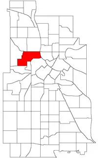 Location of Near North within the U.S. city of Minneapolis | |
| Country | United States |
| State | Minnesota |
| County | Hennepin |
| City | Minneapolis |
| Community | Near North |
| Area | |
| • Total | 1.136 sq mi (2.94 km2) |
| Population (2020)[2] | |
| • Total | 6,667 |
| • Density | 5,900/sq mi (2,300/km2) |
| Time zone | UTC-6 (CST) |
| • Summer (DST) | UTC-5 (CDT) |
| ZIP code | 55411 |
| Area code | 612 |
| Census | Pop. | Note | %± |
|---|---|---|---|
| 1980 | 5,911 | — | |
| 1990 | 6,175 | 4.5% | |
| 2000 | 6,921 | 12.1% | |
| 2010 | 5,968 | −13.8% | |
| 2020 | 6,667 | 11.7% |
Near North is a neighborhood in the Near North community of Minneapolis.
Geography and demographics
The neighborhood is located directly north of the more industrial and historic neighborhoods of Minneapolis, the North Loop. It is one of Minneapolis’s historically Black neighborhoods.[3]
It is bordered by the Hawthorne and Jordan neighborhoods to the north, St. Anthony West to the east, North Loop, Sumner-Glenwood, and Harrison to the south, and Willard-Hay to the west.
Historic structures
The neighborhood contains three buildings listed on the National Register of Historic Places:
See also
References
- ↑ "Near North neighborhood in Minneapolis, Minnesota (MN), 55411 detailed profile". City-Data. 2011. Retrieved 2013-11-17.
- ↑ "Near North neighborhood data". Minnesota Compass. Retrieved 2023-02-19.
- ↑ "How Near North came to be one of Minneapolis' largest black communities". MinnPost. 2020-01-20. Retrieved 2021-11-09.
- ↑ Near North, Minneapolis, MN. Google Earth. Retrieved 2011-03-09.
- Near North, Minneapolis, MN. Google Earth. Retrieved 2011-03-09.
External links
Places adjacent to Near North (neighborhood), Minneapolis | |
|---|---|
This article is issued from Wikipedia. The text is licensed under Creative Commons - Attribution - Sharealike. Additional terms may apply for the media files.