Regina | |
|---|---|
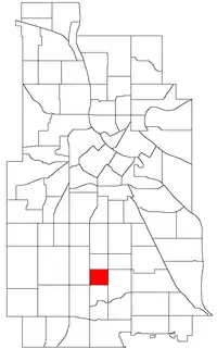 Location of Regina within the U.S. city of Minneapolis | |
| Country | United States |
| State | Minnesota |
| County | Hennepin |
| City | Minneapolis |
| Community | Nokomis |
| Area | |
| • Total | 0.299 sq mi (0.77 km2) |
| Population (2020)[2] | |
| • Total | 2,331 |
| • Density | 7,800/sq mi (3,000/km2) |
| Time zone | UTC-6 (CST) |
| • Summer (DST) | UTC-5 (CDT) |
| ZIP code | 55407, 55409 |
| Area code | 612 |
| Census | Pop. | Note | %± |
|---|---|---|---|
| 1980 | 2,550 | — | |
| 1990 | 2,474 | −3.0% | |
| 2000 | 2,489 | 0.6% | |
| 2010 | 2,292 | −7.9% | |
| 2020 | 2,331 | 1.7% |
Regina is a neighborhood within the Nokomis community in Minneapolis, Minnesota. Its boundaries are 42nd Street to the north, Chicago Avenue to the east, 46th Street to the south, and Interstate 35W to the west. It shares a neighborhood organization with the Field and Northrop neighborhoods. 44°55′22″N 93°16′15″W / 44.9228°N 93.2708°W[3]
References
- ↑ "Regina neighborhood in Minneapolis, Minnesota (MN), 55407, 55409 detailed profile". City-Data. 2011. Retrieved 2013-11-17.
- ↑ "Regina neighborhood data". Minnesota Compass. Retrieved 2023-02-19.
- ↑ Regina, Minneapolis, MN. Google Earth. Retrieved 2011-03-09.
- Regina, Minneapolis, MN. Google Earth. Retrieved 2011-03-09.
External links
Wikimedia Commons has media related to Regina, Minneapolis.
This article is issued from Wikipedia. The text is licensed under Creative Commons - Attribution - Sharealike. Additional terms may apply for the media files.