Gandelu | |
|---|---|
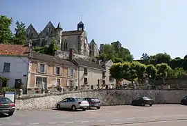 The church and square of Gandelu | |
Location of Gandelu | |
 Gandelu  Gandelu | |
| Coordinates: 49°05′44″N 3°11′02″E / 49.0956°N 3.1839°E | |
| Country | France |
| Region | Hauts-de-France |
| Department | Aisne |
| Arrondissement | Château-Thierry |
| Canton | Villers-Cotterêts |
| Intercommunality | CA Région de Château-Thierry |
| Government | |
| • Mayor (2022–2026) | Bernard Canessa[1] |
| Area 1 | 10.03 km2 (3.87 sq mi) |
| Population | 699 |
| • Density | 70/km2 (180/sq mi) |
| Time zone | UTC+01:00 (CET) |
| • Summer (DST) | UTC+02:00 (CEST) |
| INSEE/Postal code | 02339 /02810 |
| Elevation | 68–166 m (223–545 ft) (avg. 77 m or 253 ft) |
| 1 French Land Register data, which excludes lakes, ponds, glaciers > 1 km2 (0.386 sq mi or 247 acres) and river estuaries. | |
Gandelu (French pronunciation: [ɡɑ̃dly]) is a commune in the Aisne department in Hauts-de-France in northern France. It belongs to the arrondissement of Château-Thierry and to the canton of Villers-Cotterêts.
Population
| Year | Pop. | ±% p.a. |
|---|---|---|
| 1968 | 326 | — |
| 1975 | 291 | −1.61% |
| 1982 | 346 | +2.50% |
| 1990 | 537 | +5.65% |
| 1999 | 641 | +1.99% |
| 2007 | 675 | +0.65% |
| 2012 | 686 | +0.32% |
| 2017 | 687 | +0.03% |
| Source: INSEE[3] | ||
See also
References
- ↑ "Répertoire national des élus: les maires" (in French). data.gouv.fr, Plateforme ouverte des données publiques françaises. 6 June 2023.
- ↑ "Populations légales 2021". The National Institute of Statistics and Economic Studies. 28 December 2023.
- ↑ Population en historique depuis 1968, INSEE
Wikimedia Commons has media related to Gandelu.
This article is issued from Wikipedia. The text is licensed under Creative Commons - Attribution - Sharealike. Additional terms may apply for the media files.