Mareuil-en-Dôle | |
|---|---|
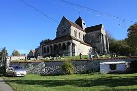 The church of Mareuil-en-Dôle | |
Location of Mareuil-en-Dôle | |
 Mareuil-en-Dôle  Mareuil-en-Dôle | |
| Coordinates: 49°14′30″N 3°33′27″E / 49.2417°N 3.5575°E | |
| Country | France |
| Region | Hauts-de-France |
| Department | Aisne |
| Arrondissement | Château-Thierry |
| Canton | Fère-en-Tardenois |
| Intercommunality | CA Région de Château-Thierry |
| Government | |
| • Mayor (2020–2026) | Régine Domingues[1] |
| Area 1 | 8.81 km2 (3.40 sq mi) |
| Population | 226 |
| • Density | 26/km2 (66/sq mi) |
| Time zone | UTC+01:00 (CET) |
| • Summer (DST) | UTC+02:00 (CEST) |
| INSEE/Postal code | 02462 /02130 |
| Elevation | 73–203 m (240–666 ft) (avg. 176 m or 577 ft) |
| 1 French Land Register data, which excludes lakes, ponds, glaciers > 1 km2 (0.386 sq mi or 247 acres) and river estuaries. | |
Mareuil-en-Dôle (French pronunciation: [maʁœj ɑ̃ dol]) is a commune in the Aisne department in Hauts-de-France in northern France.
Population
| Year | Pop. | ±% |
|---|---|---|
| 1962 | 226 | — |
| 1968 | 176 | −22.1% |
| 1975 | 148 | −15.9% |
| 1982 | 150 | +1.4% |
| 1990 | 181 | +20.7% |
| 1999 | 184 | +1.7% |
| 2008 | 222 | +20.7% |
See also
References
- ↑ "Répertoire national des élus: les maires". data.gouv.fr, Plateforme ouverte des données publiques françaises (in French). 9 August 2021.
- ↑ "Populations légales 2021". The National Institute of Statistics and Economic Studies. 28 December 2023.
Wikimedia Commons has media related to Mareuil-en-Dôle.
This article is issued from Wikipedia. The text is licensed under Creative Commons - Attribution - Sharealike. Additional terms may apply for the media files.