Saint-Aubin | |
|---|---|
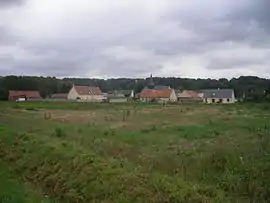 A general view of Saint-Aubin | |
Location of Saint-Aubin | |
 Saint-Aubin  Saint-Aubin | |
| Coordinates: 49°30′31″N 3°11′23″E / 49.5086°N 3.1897°E | |
| Country | France |
| Region | Hauts-de-France |
| Department | Aisne |
| Arrondissement | Laon |
| Canton | Vic-sur-Aisne |
| Government | |
| • Mayor (2020–2026) | Benoît Philipon[1] |
| Area 1 | 8.36 km2 (3.23 sq mi) |
| Population | 280 |
| • Density | 33/km2 (87/sq mi) |
| Time zone | UTC+01:00 (CET) |
| • Summer (DST) | UTC+02:00 (CEST) |
| INSEE/Postal code | 02671 /02300 |
| Elevation | 49–154 m (161–505 ft) (avg. 60 m or 200 ft) |
| 1 French Land Register data, which excludes lakes, ponds, glaciers > 1 km2 (0.386 sq mi or 247 acres) and river estuaries. | |
Saint-Aubin (French pronunciation: [sɛ̃.t‿obɛ̃] ⓘ) is a commune in the Aisne department and Hauts-de-France region of northern France.
Population
| Year | Pop. | ±% |
|---|---|---|
| 1962 | 310 | — |
| 1968 | 270 | −12.9% |
| 1975 | 248 | −8.1% |
| 1982 | 251 | +1.2% |
| 1990 | 239 | −4.8% |
| 1999 | 273 | +14.2% |
| 2008 | 316 | +15.8% |
| 2014 | 311 | −1.6% |
See also
References
- ↑ "Répertoire national des élus: les maires" (in French). data.gouv.fr, Plateforme ouverte des données publiques françaises. 13 September 2022.
- ↑ "Populations légales 2021". The National Institute of Statistics and Economic Studies. 28 December 2023.
Wikimedia Commons has media related to Saint-Aubin, Aisne.
This article is issued from Wikipedia. The text is licensed under Creative Commons - Attribution - Sharealike. Additional terms may apply for the media files.