Guyencourt | |
|---|---|
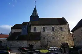 The church of Guyencourt | |
Location of Guyencourt | |
 Guyencourt  Guyencourt | |
| Coordinates: 49°21′26″N 3°50′13″E / 49.3572°N 3.8369°E | |
| Country | France |
| Region | Hauts-de-France |
| Department | Aisne |
| Arrondissement | Laon |
| Canton | Villeneuve-sur-Aisne |
| Intercommunality | Champagne Picarde |
| Government | |
| • Mayor (2020–2026) | Didier Lachambre[1] |
| Area 1 | 4.2 km2 (1.6 sq mi) |
| Population | 250 |
| • Density | 60/km2 (150/sq mi) |
| Time zone | UTC+01:00 (CET) |
| • Summer (DST) | UTC+02:00 (CEST) |
| INSEE/Postal code | 02364 /02160 |
| Elevation | 73–200 m (240–656 ft) (avg. 109 m or 358 ft) |
| 1 French Land Register data, which excludes lakes, ponds, glaciers > 1 km2 (0.386 sq mi or 247 acres) and river estuaries. | |
Guyencourt is a commune in the Aisne department in Hauts-de-France in northern France.
Population
| Year | Pop. | ±% p.a. |
|---|---|---|
| 1968 | 113 | — |
| 1975 | 114 | +0.13% |
| 1982 | 135 | +2.44% |
| 1990 | 191 | +4.43% |
| 1999 | 224 | +1.79% |
| 2009 | 230 | +0.26% |
| 2014 | 226 | −0.35% |
| 2020 | 254 | +1.97% |
| Source: INSEE[3] | ||
See also
References
- ↑ "Répertoire national des élus: les maires". data.gouv.fr, Plateforme ouverte des données publiques françaises (in French). 9 August 2021.
- ↑ "Populations légales 2021". The National Institute of Statistics and Economic Studies. 28 December 2023.
- ↑ Population en historique depuis 1968, INSEE
Wikimedia Commons has media related to Guyencourt.
This article is issued from Wikipedia. The text is licensed under Creative Commons - Attribution - Sharealike. Additional terms may apply for the media files.