Raillimont | |
|---|---|
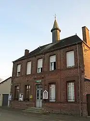 Town hall | |
Location of Raillimont | |
 Raillimont  Raillimont | |
| Coordinates: 49°42′21″N 4°09′17″E / 49.7058°N 4.1547°E | |
| Country | France |
| Region | Hauts-de-France |
| Department | Aisne |
| Arrondissement | Vervins |
| Canton | Vervins |
| Intercommunality | Portes de la Thiérache |
| Government | |
| • Mayor (2020–2026) | Monique Loriette[1] |
| Area 1 | 4.9 km2 (1.9 sq mi) |
| Population | 89 |
| • Density | 18/km2 (47/sq mi) |
| Time zone | UTC+01:00 (CET) |
| • Summer (DST) | UTC+02:00 (CEST) |
| INSEE/Postal code | 02634 /02360 |
| Elevation | 139–224 m (456–735 ft) (avg. 147 m or 482 ft) |
| 1 French Land Register data, which excludes lakes, ponds, glaciers > 1 km2 (0.386 sq mi or 247 acres) and river estuaries. | |
Raillimont (French pronunciation: [ʁajimɔ̃]) is a commune in the Aisne department in Hauts-de-France in northern France.
Population
| Year | Pop. | ±% p.a. |
|---|---|---|
| 1968 | 85 | — |
| 1975 | 72 | −2.34% |
| 1982 | 83 | +2.05% |
| 1990 | 86 | +0.44% |
| 1999 | 77 | −1.22% |
| 2007 | 85 | +1.24% |
| 2012 | 82 | −0.72% |
| 2017 | 79 | −0.74% |
| Source: INSEE[3] | ||
See also
References
- ↑ "Répertoire national des élus: les maires". data.gouv.fr, Plateforme ouverte des données publiques françaises (in French). 2 December 2020.
- ↑ "Populations légales 2021". The National Institute of Statistics and Economic Studies. 28 December 2023.
- ↑ Population en historique depuis 1968, INSEE
Wikimedia Commons has media related to Raillimont.
This article is issued from Wikipedia. The text is licensed under Creative Commons - Attribution - Sharealike. Additional terms may apply for the media files.