Garidech | |
|---|---|
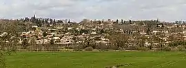 A general view of Garidech | |
.svg.png.webp) Coat of arms | |
Location of Garidech | |
 Garidech  Garidech | |
| Coordinates: 43°42′32″N 1°33′42″E / 43.7089°N 1.5617°E | |
| Country | France |
| Region | Occitania |
| Department | Haute-Garonne |
| Arrondissement | Toulouse |
| Canton | Pechbonnieu |
| Intercommunality | Coteaux du Girou |
| Government | |
| • Mayor (2020–2026) | Christian Ciercóles[1] |
| Area 1 | 7.11 km2 (2.75 sq mi) |
| Population | 1,909 |
| • Density | 270/km2 (700/sq mi) |
| Time zone | UTC+01:00 (CET) |
| • Summer (DST) | UTC+02:00 (CEST) |
| INSEE/Postal code | 31212 /31380 |
| Elevation | 132–214 m (433–702 ft) (avg. 190 m or 620 ft) |
| 1 French Land Register data, which excludes lakes, ponds, glaciers > 1 km2 (0.386 sq mi or 247 acres) and river estuaries. | |
Garidech (French pronunciation: [ɡaʁidɛʃ]; Occitan: Garidèit) is a commune in the Haute-Garonne department in southwestern France.
Population
| Year | Pop. | ±% |
|---|---|---|
| 1962 | 305 | — |
| 1968 | 318 | +4.3% |
| 1975 | 380 | +19.5% |
| 1982 | 520 | +36.8% |
| 1990 | 698 | +34.2% |
| 1999 | 954 | +36.7% |
| 2006 | 1,498 | +57.0% |
| 2008 | 1,554 | +3.7% |
| 2011 | 1,610 | +3.6% |
| 2015 | 1,741 | +8.1% |
| 2016 | 1,756 | +0.9% |
| 2018 | 1,851 | +5.4% |
The inhabitants of the commune are called Garidéchois.
Transport
Monuments
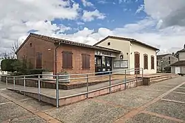 Town hall
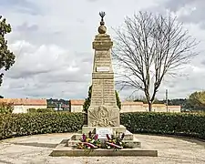 War memorial
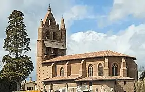 Church Saint-Jean-Baptiste
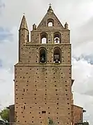 Bel gable
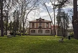 Primary school
See also
References
- ↑ "Répertoire national des élus: les maires". data.gouv.fr, Plateforme ouverte des données publiques françaises (in French). 2 December 2020.
- ↑ "Populations légales 2021". The National Institute of Statistics and Economic Studies. 28 December 2023.
Wikimedia Commons has media related to Garidech.
This article is issued from Wikipedia. The text is licensed under Creative Commons - Attribution - Sharealike. Additional terms may apply for the media files.