Milhas | |
|---|---|
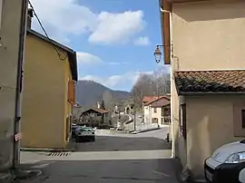 A view within Milhas | |
Location of Milhas | |
 Milhas  Milhas | |
| Coordinates: 42°59′19″N 0°48′29″E / 42.9886°N 0.8081°E | |
| Country | France |
| Region | Occitania |
| Department | Haute-Garonne |
| Arrondissement | Saint-Gaudens |
| Canton | Bagnères-de-Luchon |
| Government | |
| • Mayor (2020–2026) | Patrick Capelli[1] |
| Area 1 | 19.68 km2 (7.60 sq mi) |
| Population | 185 |
| • Density | 9.4/km2 (24/sq mi) |
| Time zone | UTC+01:00 (CET) |
| • Summer (DST) | UTC+02:00 (CEST) |
| INSEE/Postal code | 31342 /31160 |
| Elevation | 466–1,608 m (1,529–5,276 ft) (avg. 475 m or 1,558 ft) |
| 1 French Land Register data, which excludes lakes, ponds, glaciers > 1 km2 (0.386 sq mi or 247 acres) and river estuaries. | |
Milhas is a commune in the Haute-Garonne department in southwestern France.
Population
| Year | Pop. | ±% |
|---|---|---|
| 1962 | 131 | — |
| 1968 | 175 | +33.6% |
| 1975 | 171 | −2.3% |
| 1982 | 160 | −6.4% |
| 1990 | 158 | −1.2% |
| 1999 | 140 | −11.4% |
| 2008 | 174 | +24.3% |
See also
References
- ↑ "Répertoire national des élus: les maires". data.gouv.fr, Plateforme ouverte des données publiques françaises (in French). 9 August 2021.
- ↑ "Populations légales 2021". The National Institute of Statistics and Economic Studies. 28 December 2023.
Wikimedia Commons has media related to Milhas (Haute-Garonne).
This article is issued from Wikipedia. The text is licensed under Creative Commons - Attribution - Sharealike. Additional terms may apply for the media files.