Lalouret-Laffiteau | |
|---|---|
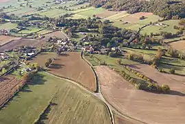 A aerial view of Lalouret | |
Location of Lalouret-Laffiteau | |
 Lalouret-Laffiteau  Lalouret-Laffiteau | |
| Coordinates: 43°11′07″N 0°42′16″E / 43.1853°N 0.7044°E | |
| Country | France |
| Region | Occitania |
| Department | Haute-Garonne |
| Arrondissement | Saint-Gaudens |
| Canton | Saint-Gaudens |
| Government | |
| • Mayor (2020–2026) | Jean-Claude Lafforgue[1] |
| Area 1 | 5.39 km2 (2.08 sq mi) |
| Population | 137 |
| • Density | 25/km2 (66/sq mi) |
| Time zone | UTC+01:00 (CET) |
| • Summer (DST) | UTC+02:00 (CEST) |
| INSEE/Postal code | 31268 /31800 |
| Elevation | 356–464 m (1,168–1,522 ft) (avg. 410 m or 1,350 ft) |
| 1 French Land Register data, which excludes lakes, ponds, glaciers > 1 km2 (0.386 sq mi or 247 acres) and river estuaries. | |
Lalouret-Laffiteau (French pronunciation: [laluʁɛ lafito]; Occitan: Laloret e era Fitau) is a commune in the Haute-Garonne department in southwestern France. As of 2017, the population of the town is 134.
Population
| Year | Pop. | ±% |
|---|---|---|
| 1962 | 104 | — |
| 1968 | 124 | +19.2% |
| 1975 | 111 | −10.5% |
| 1982 | 104 | −6.3% |
| 1990 | 113 | +8.7% |
| 1999 | 108 | −4.4% |
| 2008 | 126 | +16.7% |
See also
References
- ↑ "Répertoire national des élus: les maires". data.gouv.fr, Plateforme ouverte des données publiques françaises (in French). 2 December 2020.
- ↑ "Populations légales 2021". The National Institute of Statistics and Economic Studies. 28 December 2023.
Wikimedia Commons has media related to Lalouret-Laffiteau.
This article is issued from Wikipedia. The text is licensed under Creative Commons - Attribution - Sharealike. Additional terms may apply for the media files.