Signac | |
|---|---|
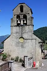 The church in Signac | |
Location of Signac | |
 Signac  Signac | |
| Coordinates: 42°54′22″N 0°37′45″E / 42.9061°N 0.6292°E | |
| Country | France |
| Region | Occitania |
| Department | Haute-Garonne |
| Arrondissement | Saint-Gaudens |
| Canton | Bagnères-de-Luchon |
| Intercommunality | Pyrénées Haut Garonnaises |
| Government | |
| • Mayor (2020–2026) | Bernard-Blaise Guaus[1] |
| Area 1 | 3.51 km2 (1.36 sq mi) |
| Population | 44 |
| • Density | 13/km2 (32/sq mi) |
| Time zone | UTC+01:00 (CET) |
| • Summer (DST) | UTC+02:00 (CEST) |
| INSEE/Postal code | 31548 /31440 |
| Elevation | 490–1,644 m (1,608–5,394 ft) (avg. 450 m or 1,480 ft) |
| 1 French Land Register data, which excludes lakes, ponds, glaciers > 1 km2 (0.386 sq mi or 247 acres) and river estuaries. | |
Signac (French pronunciation: [siɲak]; Occitan: Sinhac) is a commune in the Haute-Garonne department in southwestern France.
Population
Its inhabitants are called Signacais.[3]
| Year | Pop. | ±% |
|---|---|---|
| 1962 | 80 | — |
| 1968 | 97 | +21.2% |
| 1975 | 76 | −21.6% |
| 1982 | 75 | −1.3% |
| 1990 | 77 | +2.7% |
| 1999 | 58 | −24.7% |
| 2008 | 55 | −5.2% |
See also
References
- ↑ "Répertoire national des élus: les maires" (in French). data.gouv.fr, Plateforme ouverte des données publiques françaises. 13 September 2022.
- ↑ "Populations légales 2021". The National Institute of Statistics and Economic Studies. 28 December 2023.
- ↑ "Haute-Garonne". habitants.fr. Retrieved 22 March 2022.
Wikimedia Commons has media related to Signac.
This article is issued from Wikipedia. The text is licensed under Creative Commons - Attribution - Sharealike. Additional terms may apply for the media files.