General Villegas Airport | |||||||||||||||
|---|---|---|---|---|---|---|---|---|---|---|---|---|---|---|---|
| Summary | |||||||||||||||
| Airport type | Public | ||||||||||||||
| Serves | General Villegas, Argentina | ||||||||||||||
| Elevation AMSL | 383 ft / 117 m | ||||||||||||||
| Coordinates | 40°49′00″S 68°04′25″W / 40.81667°S 68.07361°W | ||||||||||||||
| Map | |||||||||||||||
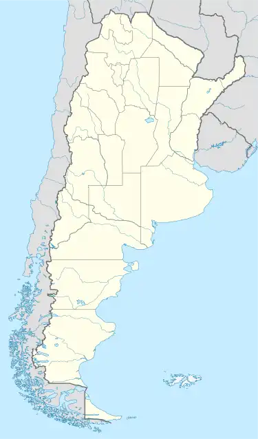
 VGS Location of the airport in Argentina | |||||||||||||||
| Runways | |||||||||||||||
| |||||||||||||||
General Villegas Airport (IATA: VGS) is an airport serving the town of General Villegas in the Buenos Aires Province of Argentina. The airport is 3 kilometres (2 mi) north of General Villegas.
The airport has crossing runways. The asphalt Runway 03/21 is marked closed. The 910 metres (2,990 ft) grass Runway 13/31 is marked closed as of 11/17/2016. Google Earth Historical Imagery shows the runway was closed sometime after 3/4/2016 due to flooding in its central section.[3]
The Laboulaye VOR (Ident: LYE) is located 54.6 nautical miles (101 km) north-northwest of the airport. The General Pico VOR (Ident: GPI) is located 55.5 nautical miles (103 km) southwest of General Villegas Airport.[4][5]
See also
 Argentina portal
 Aviation portal
- Transport in Argentina
- List of airports in Argentina
- Talk:General Villegas Airport
References
- ↑ Airport information for General Villegas Airport at Great Circle Mapper.
- ↑ "General Villegas Airport". Google Maps. Retrieved 3 April 2019.
- ↑ Google Earth Historical Imagery (3/4/2016), (11/17/2016)
- ↑ "General Pico VOR". Our Airports. Retrieved 3 April 2019.
- ↑ "Laboulaye VOR". Our Airports. Retrieved 3 April 2019.
External links
- OpenStreetMap - General Villegas
- OurAirports - General Villegas Airport
- Accident history for General Villegas Airport at Aviation Safety Network
This article is issued from Wikipedia. The text is licensed under Creative Commons - Attribution - Sharealike. Additional terms may apply for the media files.