Gerger District | |
|---|---|
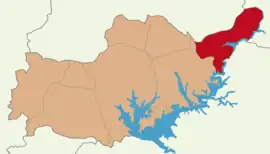 Map showing Gerger District in Adıyaman Province | |
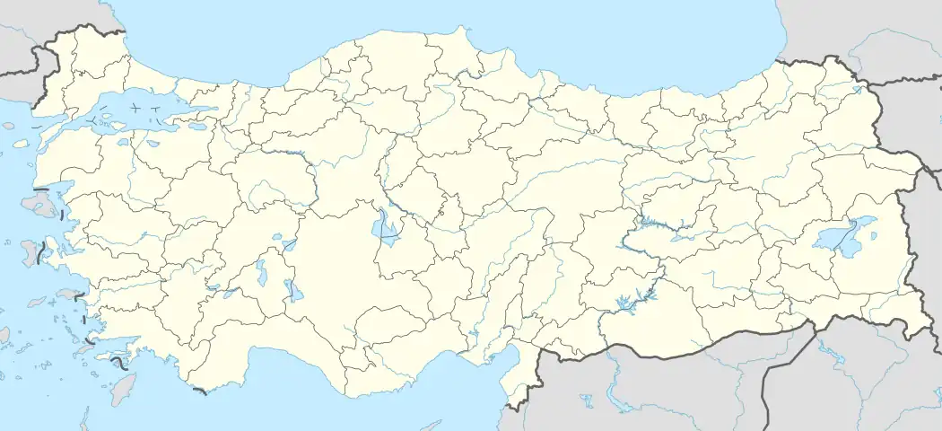 Gerger District Location in Turkey | |
| Coordinates: 38°02′N 39°02′E / 38.033°N 39.033°E | |
| Country | Turkey |
| Province | Adıyaman |
| Seat | Gerger |
| Government | |
| • Kaymakam | Ömer Saygılı[1] |
| Area | 668 km2 (258 sq mi) |
| Population (2021) | 16,416 |
| • Density | 25/km2 (64/sq mi) |
| Time zone | TRT (UTC+3) |
Gerger District is a district of Adıyaman Province of Turkey. Its seat is the town Gerger.[2] Its area is 668 km2,[3] and its population is 16,416 (2021).[4] The district was established in 1954.[5]
Composition
There is one municipality in Gerger District:[2]
- Gerger (Aldûş)
There are 45 villages in Gerger District:[6]
- Açma
- Ağaçlı (Sevkan)
- Aşağıdağlıca (Erbaun)
- Beşgöze (Kortiyan)
- Beybostan
- Budaklı (Nîran)
- Burçaklı (Mirtan)
- Çamiçi
- Cevizpınar
- Çifthisar (Merdîs)
- Çobanpınarı (Bilêle)
- Dağdeviren
- Dallarca (Bagoz)
- Demirtaş (Melho)
- Eskikent (Temsiyas)
- Geçitli (Averag)
- Gölyurt (Tillo)
- Gönen
- Gözpınar
- Gümüşkaşık (Keferdiş)
- Gündoğdu (Mişrak)
- Güngörmüş (Petirge)
- Gürgenli (Pêşwal)
- Güzelsu (Cimik)
- Kaşyazı (Lagin)
- Kesertaş (Perdusu)
- Kılıç (Bekiran)
- Köklüce (Olbiş)
- Konacık (Bibol)
- Korulu (Barzo)
- Koşarlar (Nîrîn)
- Kütüklü (Haşur)
- Nakışlı (Horiyan)
- Onevler (Golani)
- Ortaca (Haburman)
- Oymaklı
- Saraycık (Masronî)
- Seyitmahmut
- Sutepe (Xizori)
- Üçkaya (Draxo)
- Yağmurlu (Vankuk)
- Yayladalı (Gîvdîş)
- Yenibardak
- Yeşilyurt (Venk)
- Yukarıdağlıca
References
- ↑ "Kaymakam" (in Turkish). 19 August 2022. Retrieved 7 October 2022.
- 1 2 İlçe Belediyesi, Turkey Civil Administration Departments Inventory. Retrieved 12 January 2023.
- ↑ "İl ve İlçe Yüz ölçümleri". General Directorate of Mapping. Retrieved 12 January 2023.
- ↑ "Address-based population registration system (ADNKS) results dated 31 December 2021" (XLS) (in Turkish). TÜİK. Retrieved 12 January 2023.
- ↑ "İl İdaresi ve Mülki Bölümler Şube Müdürlüğü İstatistikleri - İl ve İlçe Kuruluş Tarihleri" (PDF) (in Turkish). p. 3. Retrieved 27 December 2022.
- 1 2 Köy, Turkey Civil Administration Departments Inventory. Retrieved 12 January 2023.
Gerger District in Adıyaman Province of Turkey | |||||||||||||||||||||||||||
|---|---|---|---|---|---|---|---|---|---|---|---|---|---|---|---|---|---|---|---|---|---|---|---|---|---|---|---|
| Districts | 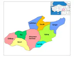 Districts of Adıyaman | ||||||||||||||||||||||||||
| |||||||||||||||||||||||||||
Metropolitan municipalities are bolded. | |||||||||||||||||||||||||||
This article is issued from Wikipedia. The text is licensed under Creative Commons - Attribution - Sharealike. Additional terms may apply for the media files.