Glenbrook Beach
Kahawai | |
|---|---|
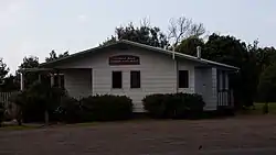 Glenbrook Beach Community Hall | |
| Coordinates: 37°09′47″S 174°42′47″E / 37.163°S 174.713°E | |
| Country | New Zealand |
| Region | Auckland Region |
| Territorial authority | Auckland Council |
| Ward | Franklin ward |
| Board | Franklin Local Board |
| Electorates | |
| Area | |
| • Total | 0.43 km2 (0.17 sq mi) |
| Population (June 2023)[2] | |
| • Total | 550 |
| • Density | 1,300/km2 (3,300/sq mi) |
| Postcode | 2681 |
| Area code | 09 |
Glenbrook Beach is a rural community at the northern end of a peninsula formed between the Waiuku River and Taihiki River in Auckland, New Zealand. Waiuku is 14 km south by road.[3]
The area is also known as Kawahai, after a species of fish which has been a substantial food source for the local Ngāti Te Ata iwi.[4]
Glenbrook Beach was first subdivided in the mid 1920s.[5][6] Electric power supply was connected at the end of the decade.[7][8]
Demographics
Statistics New Zealand describes Glenbrook Beach as a rural settlement, which covers 0.43 km2 (0.17 sq mi)[1] and had an estimated population of 550 as of June 2023,[2] with a population density of 1,279 people per km2. Glenbrook Beach is part of the larger Glenbrook statistical area.[9]
| Year | Pop. | ±% p.a. |
|---|---|---|
| 2006 | 276 | — |
| 2013 | 300 | +1.20% |
| 2018 | 303 | +0.20% |
| Source: [10] | ||
Glenbrook Beach had a population of 303 at the 2018 New Zealand census, an increase of 3 people (1.0%) since the 2013 census, and an increase of 27 people (9.8%) since the 2006 census. There were 117 households, comprising 147 males and 156 females, giving a sex ratio of 0.94 males per female. The median age was 40.2 years (compared with 37.4 years nationally), with 66 people (21.8%) aged under 15 years, 45 (14.9%) aged 15 to 29, 150 (49.5%) aged 30 to 64, and 42 (13.9%) aged 65 or older.
Ethnicities were 88.1% European/Pākehā, 17.8% Māori, 5.0% Pacific peoples, 5.0% Asian, and 2.0% other ethnicities. People may identify with more than one ethnicity.
Although some people chose not to answer the census's question about religious affiliation, 60.4% had no religion, 24.8% were Christian, 2.0% had Māori religious beliefs and 1.0% had other religions.
Of those at least 15 years old, 39 (16.5%) people had a bachelor's or higher degree, and 36 (15.2%) people had no formal qualifications. The median income was $31,600, compared with $31,800 nationally. 45 people (19.0%) earned over $70,000 compared to 17.2% nationally. The employment status of those at least 15 was that 126 (53.2%) people were employed full-time, 27 (11.4%) were part-time, and 15 (6.3%) were unemployed.[10]
References
- 1 2 "ArcGIS Web Application". statsnz.maps.arcgis.com. Retrieved 18 August 2022.
- 1 2 "Subnational population estimates (RC, SA2), by age and sex, at 30 June 1996-2023 (2023 boundaries)". Statistics New Zealand. Retrieved 25 October 2023. (regional councils); "Subnational population estimates (TA, SA2), by age and sex, at 30 June 1996-2023 (2023 boundaries)". Statistics New Zealand. Retrieved 25 October 2023. (territorial authorities); "Subnational population estimates (urban rural), by age and sex, at 30 June 1996-2023 (2023 boundaries)". Statistics New Zealand. Retrieved 25 October 2023. (urban areas)
- ↑ Harriss, Gavin (March 2022). "NZ Topo Map" (Map). Glenbrook Beach, Auckland.
- ↑ "Story of Kawahai". Auckland Council. Retrieved 18 August 2022.
- ↑ "County Affairs—Glenbrook Beach". Franklin Times. 16 February 1925.
- ↑ "Franklin County Works". New Zealand Herald. 23 January 1926.
- ↑ "Local & General—Light for Glenbrook Beach". Franklin Times. 28 August 1929.
- ↑ "Electric Power". Franklin Times. 23 October 1929.
- ↑ 2018 Census place summary: Glenbrook
- 1 2 "Statistical area 1 dataset for 2018 Census". Statistics New Zealand. March 2020. 7010297.