| Waiuku River | |
|---|---|
 Aerial view of the Waiuku River and adjacent Glenbrook Steel Mill | |
Route of the Waiuku River | |
 Mouth of the Waiuku River  Waiuku River (New Zealand) | |
| Location | |
| Country | New Zealand |
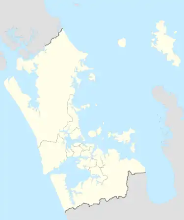
| Region | Auckland Region |
| Physical characteristics | |
| Source | |
| • location | Waiuku Stream |
| • coordinates | 37°14′59″S 174°43′55″E / 37.24959°S 174.73183°E |
| Mouth | Manukau Harbour |
• coordinates | 37°08′21″S 174°40′57″E / 37.1393°S 174.6826°E |
| Length | 12 km (7 mi) |
| Basin features | |
| Progression | Waiuku River → Manukau Harbour → Tasman Sea |
| Landmarks | Waiuku, Glenbrook Power Station, Glenbrook Beach, Clarks Beach |
| Tributaries | |
| • left | Rangiwhea Creek, Awaruaiti Creek, Mokorau Creek, Parakau Creek, Totara Creek, Waipipi Creek, Te Hakono Creek, Pukewhau Creek, Kohonui Creek, Ohiku Creek |
| • right | Waitangi Stream, Ruakohua Stream, Taihiki River |
The Waiuku River, also known as the Waiuku Estuary, is an estuarial arm of the Manukau Harbour, near the town of Waiuku, south-west of Auckland. It joins the harbour at the south west and extends south for 12 kilometres (7 mi), having its head close to the town of Waiuku.[1]
Gallery
.jpg.webp) Buildings along the edge of the Waiuku River (circa 1911)
Buildings along the edge of the Waiuku River (circa 1911)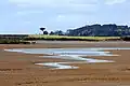 The Waiuku River at low tide in 2000
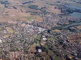 Southern end of the Waiuku River, as it meets the township of Waiuku
References
- ↑ "Waiuku River". New Zealand Gazetteer. Retrieved 8 November 2023.
This article is issued from Wikipedia. The text is licensed under Creative Commons - Attribution - Sharealike. Additional terms may apply for the media files.