Groot Henar | |
|---|---|
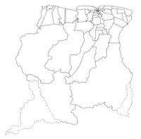
 Map showing the resorts of Nickerie District. Groot Henar | |
| Country | |
| District | Nickerie District |
| Area | |
| • Total | 2,185 km2 (844 sq mi) |
| Elevation | 0 m (0 ft) |
| Population (2012)[1] | |
| • Total | 2,709 |
| • Density | 1.2/km2 (3.2/sq mi) |
| Time zone | UTC-3 (AST) |
Groot Henar is a resort in Suriname, located in the Nickerie District, near the bridge over the Nickerie River.[2] Its population at the 2012 census was 2,709, most of which are East Indian.[1] The resort has been named after the plantation Henar which was turned into small agricultural plots after the abolition of slavery.[3] The cultivatable area was increased with the Henarpolder created in the 1920s. 1970 the Europolder was created adding 3,700 hectares to the resort.[4]
Groot Henar has a school, and a clinic.[2]
References
- 1 2 "2012 Census Resorts Suriname" (PDF). Spang Staging. Retrieved 26 May 2020.
- 1 2 "Structuur Analyse" (PDF). Planning Office Suriname (in Dutch). Retrieved 26 May 2020.
- ↑ "Slaverij in Suriname". Slavernij Eloweb (in Dutch). Retrieved 26 May 2020.
- ↑ "De opkomst van de rijstcultuur en de polders". Nickerie.nl (in Dutch). Retrieved 27 May 2020.
This article is issued from Wikipedia. The text is licensed under Creative Commons - Attribution - Sharealike. Additional terms may apply for the media files.