Horoušany | |
|---|---|
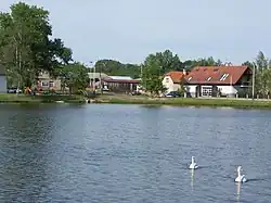 Pond in the centre of Horoušany | |
 Flag  Coat of arms | |
 Horoušany Location in the Czech Republic | |
| Coordinates: 50°6′23″N 14°44′26″E / 50.10639°N 14.74056°E | |
| Country | |
| Region | Central Bohemian |
| District | Prague-East |
| First mentioned | 1238 |
| Area | |
| • Total | 7.06 km2 (2.73 sq mi) |
| Elevation | 216 m (709 ft) |
| Population (2023-01-01)[1] | |
| • Total | 1,764 |
| • Density | 250/km2 (650/sq mi) |
| Time zone | UTC+1 (CET) |
| • Summer (DST) | UTC+2 (CEST) |
| Postal code | 250 82 |
| Website | www |
Horoušany (Czech pronunciation: [ˈondr̝ɛjof]) is a municipality and village in Prague-East District in the Central Bohemian Region of the Czech Republic. It has about 1,800 inhabitants.
Administrative parts
The village of Horoušánky is an administrative part of Horoušany.
References
Wikimedia Commons has media related to Horoušany.
This article is issued from Wikipedia. The text is licensed under Creative Commons - Attribution - Sharealike. Additional terms may apply for the media files.