Oplany | |
|---|---|
 Upper common | |
 Flag  Coat of arms | |
 Oplany Location in the Czech Republic | |
| Coordinates: 49°55′27″N 14°52′2″E / 49.92417°N 14.86722°E | |
| Country | |
| Region | Central Bohemian |
| District | Prague-East |
| First mentioned | 1379 |
| Area | |
| • Total | 5.81 km2 (2.24 sq mi) |
| Elevation | 357 m (1,171 ft) |
| Population (2023-01-01)[1] | |
| • Total | 105 |
| • Density | 18/km2 (47/sq mi) |
| Time zone | UTC+1 (CET) |
| • Summer (DST) | UTC+2 (CEST) |
| Postal code | 281 63 |
| Website | www |
Oplany is a municipality and village in Prague-East District in the Central Bohemian Region of the Czech Republic. It has about 100 inhabitants.
History
The first written mention of Oplany is from 1379.[2]
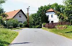
Gallery
 Chapel of the Assumption of the Virgin Mary
 Bus stop
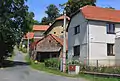 Side street
References
- ↑ "Population of Municipalities – 1 January 2023". Czech Statistical Office. 2023-05-23.
- ↑ "Historie obce" (in Czech). Obec Oplany. Retrieved 2022-03-21.
Wikimedia Commons has media related to Oplany.
This article is issued from Wikipedia. The text is licensed under Creative Commons - Attribution - Sharealike. Additional terms may apply for the media files.