Sulice | |
|---|---|
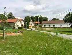 Centre of Sulice | |
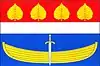 Flag 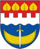 Coat of arms | |
 Sulice Location in the Czech Republic | |
| Coordinates: 49°55′33″N 14°33′24″E / 49.92583°N 14.55667°E | |
| Country | |
| Region | Central Bohemian |
| District | Prague-East |
| First mentioned | 1282 |
| Area | |
| • Total | 9.92 km2 (3.83 sq mi) |
| Elevation | 445 m (1,460 ft) |
| Population (2023-01-01)[1] | |
| • Total | 2,411 |
| • Density | 240/km2 (630/sq mi) |
| Time zone | UTC+1 (CET) |
| • Summer (DST) | UTC+2 (CEST) |
| Postal code | 251 68 |
| Website | www |
Sulice is a municipality and village in Prague-East District in the Central Bohemian Region of the Czech Republic. It has about 2,400 inhabitants.
Administrative parts
Villages of Hlubočinka, Nechánice and Želivec are administrative parts of Sulice.
Geography
Sulice is located about 12 km (7 mi) south of Prague. It lies in the Benešov Uplands. The highest point is the hill Mandava at 480 m (1,570 ft) above sea level. There are several small ponds in the territory.
History
The first written mention of Sulice is from 1282, Nechánice was first mentioned in 1349 and Želivec in 1402.[2]
Sights
On the Mandava hill there is a concrete monument to Jan Hus from 1931, which also includes a 12 m (39 ft) high observation tower.[3]
Gallery
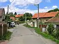 Northern part
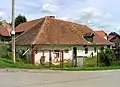 Old house
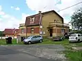 Municipal office
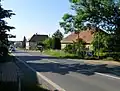 The village of Hlubočinka
References
- ↑ "Population of Municipalities – 1 January 2023". Czech Statistical Office. 2023-05-23.
- ↑ "Historie obce" (in Czech). Obec Sulice. Retrieved 2023-03-30.
- ↑ "Rozhledna Mandava" (in Czech). Rozhlednovým rájem.cz. Retrieved 2023-03-30.
External links
Wikimedia Commons has media related to Sulice.
This article is issued from Wikipedia. The text is licensed under Creative Commons - Attribution - Sharealike. Additional terms may apply for the media files.