Hroznová Lhota | |
|---|---|
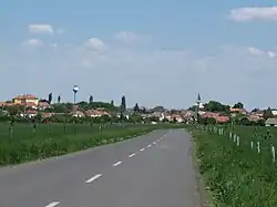 General view of Hroznová Lhota | |
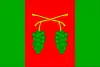 Flag 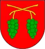 Coat of arms | |
 Hroznová Lhota Location in the Czech Republic | |
| Coordinates: 48°54′28″N 17°25′1″E / 48.90778°N 17.41694°E | |
| Country | |
| Region | South Moravian |
| District | Hodonín |
| First mentioned | 1371 |
| Area | |
| • Total | 9.05 km2 (3.49 sq mi) |
| Elevation | 203 m (666 ft) |
| Population (2023-01-01)[1] | |
| • Total | 1,152 |
| • Density | 130/km2 (330/sq mi) |
| Time zone | UTC+1 (CET) |
| • Summer (DST) | UTC+2 (CEST) |
| Postal code | 696 63 |
| Website | www |
Hroznová Lhota is a municipality and village in Hodonín District in the South Moravian Region of the Czech Republic. It has about 1,200 inhabitants.
Etymology
The municipality has a long vine-growing tradition, hence the name meaning Grapes' Lhota which has been in use since late 16th century. Prior it the municipality was named just Lhota or Lhota Veselská.[2]
Geography
Hroznová Lhota is located at northern foothill of the White Carpathians mountain range, about 22 kilometres (14 mi) northeast of Hodonín. The White Carpathians Protected Landscape Area extends from the south just into centre of the municipality.
Notable people
- Joža Uprka (1861–1940), painter; lived and died here
References
- ↑ "Population of Municipalities – 1 January 2023". Czech Statistical Office. 2023-05-23.
- ↑ "Historie a současnost obce Hroznová Lhota" (in Czech). Obec Hroznová Lhota. Retrieved 2020-10-28.
External links
Wikimedia Commons has media related to Hroznová Lhota.
This article is issued from Wikipedia. The text is licensed under Creative Commons - Attribution - Sharealike. Additional terms may apply for the media files.