Iğdır District | |
|---|---|
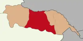 Map showing Iğdır District in Iğdır Province | |
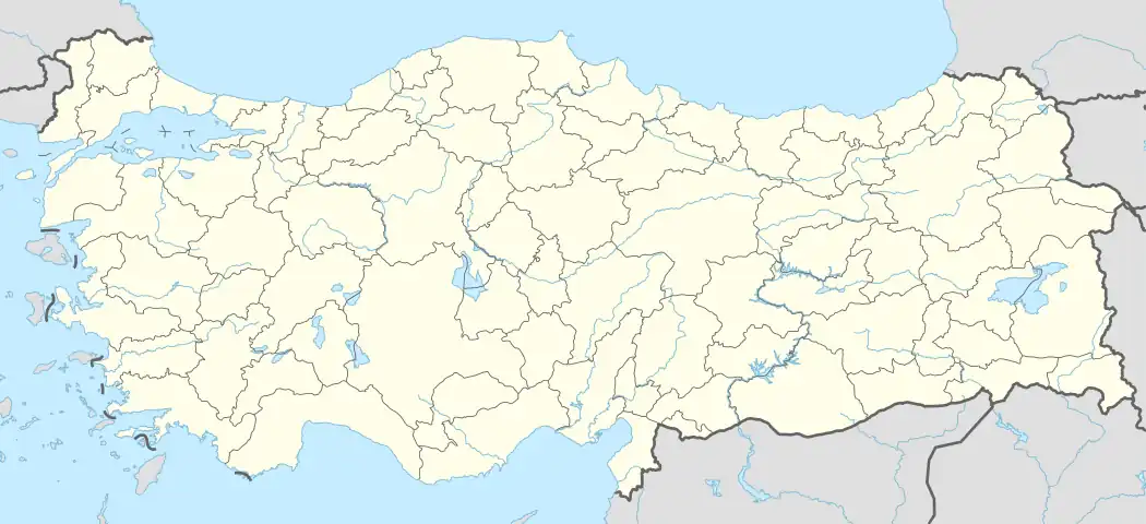 Iğdır District Location in Turkey | |
| Coordinates: 39°55′N 44°03′E / 39.917°N 44.050°E | |
| Country | Turkey |
| Province | Iğdır |
| Seat | Iğdır |
| Area | 1,273 km2 (492 sq mi) |
| Population (2022) | 147,197 |
| • Density | 120/km2 (300/sq mi) |
| Time zone | TRT (UTC+3) |
Iğdır District (also: Merkez, meaning "central" in Turkish) is a district of the Iğdır Province of Turkey. Its seat is the city of Iğdır.[1] Its area is 1,273 km2,[2] and its population is 147,197 (2022).[3] It lies on the border with Armenia.
Composition
There are four municipalities in Iğdır District:[1][4]
There are 41 villages in Iğdır District:[5]
- Ağaver
- Akyumak
- Alibeyköy
- Asma
- Aşağıçarıkçı
- Aşağıerhacı
- Bayraktutan
- Bendemurat
- Çakırtaş
- Çalpala
- Çilli
- Elmagöl
- Enginalan
- Evci
- Gülpınar
- Güngörmez
- Hakmehmet
- Harmandöven
- Kadıkışlak
- Karagüney
- Karakuyu
- Kasımcan
- Kavaktepe
- Kazancı
- Kuzugüden
- Küllük
- Mezraa
- Necefali
- Nişankaya
- Obaköy
- Örüşmüş
- Panik
- Pınarbaşı
- Sarıçoban
- Suveren
- Tacirli
- Taşlıca
- Yaycı
- Yukarıçarıkçı
- Yüzbaşılar
- Zor
References
- 1 2 İl Belediyesi, Turkey Civil Administration Departments Inventory. Retrieved 1 March 2023.
- ↑ "İl ve İlçe Yüz ölçümleri". General Directorate of Mapping. Retrieved 1 March 2023.
- ↑ "Address-based population registration system (ADNKS) results dated 31 December 2022, Favorite Reports" (XLS). TÜİK. Retrieved 13 March 2023.
- ↑ Belde Belediyesi, Turkey Civil Administration Departments Inventory. Retrieved 1 March 2023.
- ↑ Köy, Turkey Civil Administration Departments Inventory. Retrieved 1 March 2023.
Iğdır District in Iğdır Province of Turkey | |||||||||||||||||||||||||||
|---|---|---|---|---|---|---|---|---|---|---|---|---|---|---|---|---|---|---|---|---|---|---|---|---|---|---|---|
| Districts | 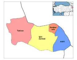 Districts of Iğdır | ||||||||||||||||||||||||||
| |||||||||||||||||||||||||||
Metropolitan municipalities are bolded. | |||||||||||||||||||||||||||
| Municipalities | |
|---|---|
| Villages |
|
This article is issued from Wikipedia. The text is licensed under Creative Commons - Attribution - Sharealike. Additional terms may apply for the media files.