Krátká Ves | |
|---|---|
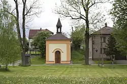 Chapel and municipal office | |
 Flag  Coat of arms | |
 Krátká Ves Location in the Czech Republic | |
| Coordinates: 49°37′33″N 15°41′4″E / 49.62583°N 15.68444°E | |
| Country | |
| Region | Vysočina |
| District | Havlíčkův Brod |
| First mentioned | 1303 |
| Area | |
| • Total | 5.70 km2 (2.20 sq mi) |
| Elevation | 498 m (1,634 ft) |
| Population (2023-01-01)[1] | |
| • Total | 128 |
| • Density | 22/km2 (58/sq mi) |
| Time zone | UTC+1 (CET) |
| • Summer (DST) | UTC+2 (CEST) |
| Postal code | 582 22 |
| Website | kratkaves |
Krátká Ves is a municipality and village in Havlíčkův Brod District in the Vysočina Region of the Czech Republic. It has about 100 inhabitants.
Krátká Ves lies approximately 9 kilometres (6 mi) east of Havlíčkův Brod, 27 km (17 mi) north of Jihlava, and 105 km (65 mi) south-east of Prague.
References
Wikimedia Commons has media related to Krátká Ves.
This article is issued from Wikipedia. The text is licensed under Creative Commons - Attribution - Sharealike. Additional terms may apply for the media files.