Okrouhlice | |
|---|---|
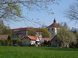
 Okrouhlice Castle | |
 Flag  Coat of arms | |
 Okrouhlice Location in the Czech Republic | |
| Coordinates: 49°37′48″N 15°29′27″E / 49.63000°N 15.49083°E | |
| Country | |
| Region | Vysočina |
| District | Havlíčkův Brod |
| First mentioned | 1207 |
| Area | |
| • Total | 18.58 km2 (7.17 sq mi) |
| Elevation | 405 m (1,329 ft) |
| Population (2023-01-01)[1] | |
| • Total | 1,380 |
| • Density | 74/km2 (190/sq mi) |
| Time zone | UTC+1 (CET) |
| • Summer (DST) | UTC+2 (CEST) |
| Postal codes | 580 01, 582 31 |
| Website | www |
Okrouhlice is a municipality and village in Havlíčkův Brod District in the Vysočina Region of the Czech Republic. It has about 1,400 inhabitants.
Administrative parts
Villages of Babice, Chlístov, Olešnice and Vadín are administrative parts of Okrouhlice.
Geography
Okrouhlice is located about 6 kilometres (4 mi) west of Havlíčkův Brod and 26 km (16 mi) north of Jihlava. It lies in the Upper Sázava Hills. The highest point is at 477 m (1,565 ft) above sea level. The Sázava River flows through the municipality.
History
The first written mention of Okrouhlice is in a deed of the Vilémov (Havlíčkův Brod District) Monastery from 1207. It was founded during the colonization in the second half of the 12th century.[2]
Transport
Okrouhlice is located on the railway line Havlíčkův Brod–Ledeč nad Sázavou.[3]
Sights
The main landmark is the Okrouhlice Castle. Originally it was a Gothic fortress from the 14th century, rebuilt into the simple Renaissance castle. At the end of the 17th century, it was extended by a second wing.[4]
Notable people
- Jan Zrzavý (1890–1977), painter
References
- ↑ "Population of Municipalities – 1 January 2023". Czech Statistical Office. 2023-05-23.
- ↑ "Strategie rozvoje obce Okrouhlice na období 2015–2020" (in Czech). Obec Okrouhlice. November 2015. pp. 3–4. Retrieved 2023-08-25.
- ↑ "Detail stanice Okrouhlice" (in Czech). České dráhy. Retrieved 2023-08-25.
- ↑ "Zámek s tvrzí" (in Czech). National Heritage Institute. Retrieved 2023-08-25.