Leština u Světlé | |
|---|---|
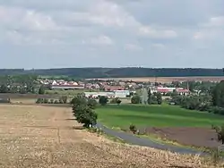 General view | |
 Flag  Coat of arms | |
 Leština u Světlé Location in the Czech Republic | |
| Coordinates: 49°45′41″N 15°23′52″E / 49.76139°N 15.39778°E | |
| Country | |
| Region | Vysočina |
| District | Havlíčkův Brod |
| First mentioned | 1327 |
| Area | |
| • Total | 18.19 km2 (7.02 sq mi) |
| Elevation | 455 m (1,493 ft) |
| Population (2023-01-01)[1] | |
| • Total | 538 |
| • Density | 30/km2 (77/sq mi) |
| Time zone | UTC+1 (CET) |
| • Summer (DST) | UTC+2 (CEST) |
| Postal codes | 582 82, 582 86, 584 01 |
| Website | www |
Leština u Světlé is a municipality and village in Havlíčkův Brod District in the Vysočina Region of the Czech Republic. It has about 500 inhabitants.
Leština u Světlé lies approximately 23 kilometres (14 mi) north-west of Havlíčkův Brod, 44 km (27 mi) north of Jihlava, and 79 km (49 mi) south-east of Prague.
Administrative parts
Villages of Dobrnice, Štěpánov and Vrbice are administrative parts of Leština u Světlé.
References
Wikimedia Commons has media related to Leština u Světlé.
This article is issued from Wikipedia. The text is licensed under Creative Commons - Attribution - Sharealike. Additional terms may apply for the media files.