La Chapelle-Gonaguet | |
|---|---|
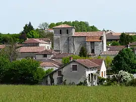 The church and surroundings in La Chapelle-Gonaguet | |
Location of La Chapelle-Gonaguet | |
 La Chapelle-Gonaguet  La Chapelle-Gonaguet | |
| Coordinates: 45°13′53″N 0°36′50″E / 45.2314°N 0.6139°E | |
| Country | France |
| Region | Nouvelle-Aquitaine |
| Department | Dordogne |
| Arrondissement | Périgueux |
| Canton | Saint-Astier |
| Intercommunality | Le Grand Périgueux |
| Government | |
| • Mayor (2020–2026) | Franck Moissat[1] |
| Area 1 | 19.07 km2 (7.36 sq mi) |
| Population | 1,067 |
| • Density | 56/km2 (140/sq mi) |
| Time zone | UTC+01:00 (CET) |
| • Summer (DST) | UTC+02:00 (CEST) |
| INSEE/Postal code | 24108 /24350 |
| Elevation | 95–233 m (312–764 ft) (avg. 179 m or 587 ft) |
| 1 French Land Register data, which excludes lakes, ponds, glaciers > 1 km2 (0.386 sq mi or 247 acres) and river estuaries. | |
La Chapelle-Gonaguet (French pronunciation: [la ʃapɛl ɡɔnaɡɛ]; Occitan: La Chapela de Gonaguet) is a commune in the Dordogne department in Nouvelle-Aquitaine in southwestern France.
Population
| Year | Pop. | ±% p.a. |
|---|---|---|
| 1968 | 307 | — |
| 1975 | 331 | +1.08% |
| 1982 | 421 | +3.50% |
| 1990 | 703 | +6.62% |
| 1999 | 863 | +2.30% |
| 2009 | 1,070 | +2.17% |
| 2014 | 1,073 | +0.06% |
| 2020 | 1,076 | +0.05% |
| Source: INSEE[3] | ||
See also
References
- ↑ "Répertoire national des élus: les maires" (in French). data.gouv.fr, Plateforme ouverte des données publiques françaises. 13 September 2022.
- ↑ "Populations légales 2021". The National Institute of Statistics and Economic Studies. 28 December 2023.
- ↑ Population en historique depuis 1968, INSEE
Wikimedia Commons has media related to La Chapelle-Gonaguet.
This article is issued from Wikipedia. The text is licensed under Creative Commons - Attribution - Sharealike. Additional terms may apply for the media files.