Saint-Front-sur-Nizonne | |
|---|---|
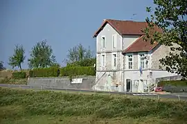 The town hall in Saint-Front-sur-Nizonne | |
Location of Saint-Front-sur-Nizonne | |
 Saint-Front-sur-Nizonne  Saint-Front-sur-Nizonne | |
| Coordinates: 45°28′56″N 0°38′12″E / 45.4822°N 0.6367°E | |
| Country | France |
| Region | Nouvelle-Aquitaine |
| Department | Dordogne |
| Arrondissement | Nontron |
| Canton | Périgord Vert Nontronnais |
| Government | |
| • Mayor (2022–2026) | Gérard Chapeau[1] |
| Area 1 | 13.05 km2 (5.04 sq mi) |
| Population | 164 |
| • Density | 13/km2 (33/sq mi) |
| Time zone | UTC+01:00 (CET) |
| • Summer (DST) | UTC+02:00 (CEST) |
| INSEE/Postal code | 24411 /24300 |
| Elevation | 153–263 m (502–863 ft) |
| 1 French Land Register data, which excludes lakes, ponds, glaciers > 1 km2 (0.386 sq mi or 247 acres) and river estuaries. | |
Saint-Front-sur-Nizonne (French pronunciation: [sɛ̃ fʁɔ̃ syʁ nizɔn], literally Saint-Front on Nizonne; Occitan: Sent Front de Champs Niers) is a commune in the Dordogne department in Nouvelle-Aquitaine in southwestern France.
In 1912, the commune of Saint-Front-de-Champniers changed its name to Saint-Front-sur-Nizonne.
Geography
The Lizonne, also called Nizonne, flows west through the middle of the commune.
Population
| Year | Pop. | ±% |
|---|---|---|
| 1962 | 43 | — |
| 1968 | 94 | +118.6% |
| 1975 | 95 | +1.1% |
| 1982 | 91 | −4.2% |
| 1990 | 122 | +34.1% |
| 1999 | 135 | +10.7% |
| 2008 | 146 | +8.1% |
See also
References
- ↑ "Répertoire national des élus: les maires" (in French). data.gouv.fr, Plateforme ouverte des données publiques françaises. 4 May 2022.
- ↑ "Populations légales 2021". The National Institute of Statistics and Economic Studies. 28 December 2023.
Wikimedia Commons has media related to Saint-Front-sur-Nizonne.
This article is issued from Wikipedia. The text is licensed under Creative Commons - Attribution - Sharealike. Additional terms may apply for the media files.