Tocane-Saint-Apre | |
|---|---|
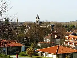 A general view of Tocane | |
Location of Tocane-Saint-Apre | |
 Tocane-Saint-Apre  Tocane-Saint-Apre | |
| Coordinates: 45°15′19″N 0°29′50″E / 45.2553°N 0.4972°E | |
| Country | France |
| Region | Nouvelle-Aquitaine |
| Department | Dordogne |
| Arrondissement | Périgueux |
| Canton | Brantôme en Périgord |
| Government | |
| • Mayor (2020–2026) | Pierre Janaillac[1] |
| Area 1 | 32.35 km2 (12.49 sq mi) |
| Population | 1,745 |
| • Density | 54/km2 (140/sq mi) |
| Time zone | UTC+01:00 (CET) |
| • Summer (DST) | UTC+02:00 (CEST) |
| INSEE/Postal code | 24553 /24350 |
| Elevation | 68–232 m (223–761 ft) (avg. 85 m or 279 ft) |
| 1 French Land Register data, which excludes lakes, ponds, glaciers > 1 km2 (0.386 sq mi or 247 acres) and river estuaries. | |
Tocane-Saint-Apre (French pronunciation: [tɔkan sɛ̃.t‿apʁ]; Occitan: Sent Abre) is a commune in the Dordogne department in Nouvelle-Aquitaine in southwestern France.
Population
| Year | Pop. | ±% p.a. |
|---|---|---|
| 1968 | 1,359 | — |
| 1975 | 1,318 | −0.44% |
| 1982 | 1,376 | +0.62% |
| 1990 | 1,377 | +0.01% |
| 1999 | 1,484 | +0.83% |
| 2009 | 1,679 | +1.24% |
| 2014 | 1,658 | −0.25% |
| 2020 | 1,738 | +0.79% |
| Source: INSEE[3] | ||
See also
References
- ↑ "Répertoire national des élus: les maires" (in French). data.gouv.fr, Plateforme ouverte des données publiques françaises. 13 September 2022.
- ↑ "Populations légales 2021". The National Institute of Statistics and Economic Studies. 28 December 2023.
- ↑ Population en historique depuis 1968, INSEE
Wikimedia Commons has media related to Tocane-Saint-Apre.
This article is issued from Wikipedia. The text is licensed under Creative Commons - Attribution - Sharealike. Additional terms may apply for the media files.