La Ferté-Hauterive | |
|---|---|
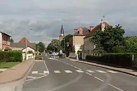 The main road in La Ferté-Hauterive | |
 Coat of arms | |
Location of La Ferté-Hauterive | |
 La Ferté-Hauterive  La Ferté-Hauterive | |
| Coordinates: 46°23′51″N 3°20′28″E / 46.3975°N 3.3411°E | |
| Country | France |
| Region | Auvergne-Rhône-Alpes |
| Department | Allier |
| Arrondissement | Moulins |
| Canton | Moulins-2 |
| Intercommunality | Saint-Pourçain Sioule Limagne |
| Government | |
| • Mayor (2023–2026) | Patricia Dechet[1] |
| Area 1 | 18.88 km2 (7.29 sq mi) |
| Population | 265 |
| • Density | 14/km2 (36/sq mi) |
| Time zone | UTC+01:00 (CET) |
| • Summer (DST) | UTC+02:00 (CEST) |
| INSEE/Postal code | 03114 /03340 |
| Elevation | 214–239 m (702–784 ft) (avg. 234 m or 768 ft) |
| 1 French Land Register data, which excludes lakes, ponds, glaciers > 1 km2 (0.386 sq mi or 247 acres) and river estuaries. | |
La Ferté-Hauterive (French pronunciation: [la fɛʁte otʁiv]) is a commune in the Allier department in central France.
Population
| Year | Pop. | ±% |
|---|---|---|
| 1962 | 396 | — |
| 1968 | 415 | +4.8% |
| 1975 | 338 | −18.6% |
| 1982 | 355 | +5.0% |
| 1990 | 273 | −23.1% |
| 1999 | 285 | +4.4% |
| 2008 | 278 | −2.5% |
| 2012 | 290 | +4.3% |
| Source: INSEE | ||
See also
References
- ↑ "Répertoire national des élus: les maires" (in French). data.gouv.fr, Plateforme ouverte des données publiques françaises. 6 June 2023.
- ↑ "Populations légales 2021". The National Institute of Statistics and Economic Studies. 28 December 2023.
Wikimedia Commons has media related to La Ferté-Hauterive.
This article is issued from Wikipedia. The text is licensed under Creative Commons - Attribution - Sharealike. Additional terms may apply for the media files.