Lahijan County
Persian: شهرستان لاهیجان | |
|---|---|
County | |
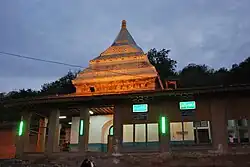 Sheikh Zahed tomb | |
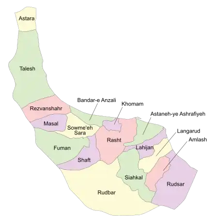 Location of Lahijan County in Gilan province (center right, purple) | |
 Location of Gilan province in Iran | |
| Coordinates: 37°14′N 50°02′E / 37.233°N 50.033°E[1] | |
| Country | |
| Province | Gilan |
| Capital | Lahijan |
| Districts | Central, Rudboneh |
| Population (2016)[2] | |
| • Total | 167,544 |
| Time zone | UTC+3:30 (IRST) |
| Lahijan County can be found at GEOnet Names Server, at this link, by opening the Advanced Search box, entering "9207021" in the "Unique Feature Id" form, and clicking on "Search Database". | |
Lahijan County (Persian: شهرستان لاهیجان) is in Gilan province, Iran. Its capital is the city of Lahijan.[3]
At the 2006 census, the county's population was 161,491 in 48,075 households.[4] The following census in 2011 counted 168,829 people in 55,174 households.[5] At the 2016 census, the county's population was 167,544 in 58,378 households.[2]
Administrative divisions
The population history of Lahijan County's administrative divisions over three consecutive censuses is shown in the following table. The latest census shows two districts, seven rural districts, and two cities.[2]
| Administrative Divisions | 2006[4] | 2011[5] | 2016[2] |
|---|---|---|---|
| Central District | 130,288 | 143,478 | 144,292 |
| Ahandan RD | 11,859 | 8,716 | 9,459 |
| Baz Kia Gurab RD | 15,029 | 12,389 | 11,603 |
| Lafmejan RD | 6,353 | 5,529 | 4,721 |
| Layalestan RD | 12,993 | 13,885 | 9,359 |
| Layl RD | 12,183 | 8,908 | 8,077 |
| Lahijan (city) | 71,871 | 94,051 | 101,073 |
| Rudboneh District | 31,203 | 25,351 | 23,252 |
| Rudboneh RD | 11,893 | 7,598 | 6,858 |
| Shirju Posht RD | 15,716 | 14,107 | 12,953 |
| Rudboneh (city) | 3,594 | 3,646 | 3,441 |
| Total | 161,491 | 168,829 | 167,544 |
| RD: Rural District | |||
Wikimedia Commons has media related to Lahijan County.
References
- ↑ OpenStreetMap contributors (4 October 2023). "Lahijan County" (Map). OpenStreetMap. Retrieved 4 October 2023.
- 1 2 3 4 "Census of the Islamic Republic of Iran, 1395 (2016)". AMAR (in Persian). The Statistical Center of Iran. p. 01. Archived from the original (Excel) on 4 December 2020. Retrieved 19 December 2022.
- ↑ Habibi, Hassan (21 June 1369). "Approval of the organization and chain of citizenship of the elements and units of the national divisions of Gilan province centered on the city of Rasht". Islamic Parliament Research Center (in Persian). Ministry of Interior, Defense Political Commission of the Government Board. Archived from the original on 12 October 2016. Retrieved 12 December 2023.
- 1 2 "Census of the Islamic Republic of Iran, 1385 (2006)". AMAR (in Persian). The Statistical Center of Iran. p. 01. Archived from the original (Excel) on 20 September 2011. Retrieved 25 September 2022.
- 1 2 "Census of the Islamic Republic of Iran, 1390 (2011)". Syracuse University (in Persian). The Statistical Center of Iran. p. 01. Archived from the original (Excel) on 8 October 2023. Retrieved 19 December 2022.
| Capital |  | |
|---|---|---|
| Counties and cities | ||
| Sights |
| |
| Populated places | ||
This article is issued from Wikipedia. The text is licensed under Creative Commons - Attribution - Sharealike. Additional terms may apply for the media files.