Linhe District
临河区 • ᠯᠢᠨ ᠾᠧ ᠲᠣᠭᠣᠷᠢᠭ Linho | |
|---|---|
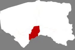
 Linhe in Bayannur | |
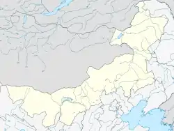
 Linhe Location in Inner Mongolia  Linhe Linhe (China) | |
| Coordinates (Linhe District government): 40°45′04″N 107°21′50″E / 40.751°N 107.364°E | |
| Country | China |
| Autonomous region | Inner Mongolia |
| Prefecture-level city | Bayannur |
| District seat | Xinhua Subdistrict |
| Area | |
| • District | 2,333 km2 (901 sq mi) |
| Population | |
| • District | 582,206 |
| • Density | 250/km2 (650/sq mi) |
| • Urban | 385,800 |
| • Rural | 169,200 |
| Time zone | UTC+8 (China Standard) |
| Website | www |
| Linhe District | |||||||
|---|---|---|---|---|---|---|---|
| Chinese name | |||||||
| Simplified Chinese | 临河区 | ||||||
| Traditional Chinese | 臨河區 | ||||||
| |||||||
| Mongolian name | |||||||
| Mongolian Cyrillic | Линьхө дүүрэг | ||||||
| Mongolian script | ᠯᠢᠨ ᠾᠧ ᠲᠣᠭᠣᠷᠢᠭ | ||||||
| |||||||
Linhe (Mongolian: ᠯᠢᠨ ᠾᠧ ᠲᠣᠭᠣᠷᠢᠭ; Chinese: 临河区) is the only district and the seat of the city of Baynnur, Inner Mongolia, situated at the northern loop of the Yellow River, south of the Lang Shan range (70 km or 43 mi south-east of the Huhebashige). The district spans an area of 2,333 square kilometers, and has a population of 555,000 inhabitants as of 2019.[1]
History
The area of present-day Linhe was first incorporated under Emperor Wu of the Han Dynasty in 127 BCE, and appears by name in Volume 28 of the Book of Han.[1]
The area remained sparsely inhabited before the late Ming Dynasty, when an exodus of people from fleeing famine in other provinces, such as Shanxi, Shaanxi, and Shandong, established new agricultural ventures in Linhe.[1]
Linhe County was established in 1925.[1]
The county was taken by Communist forces on September 19, 1949.[1]
Linhe was upgraded to a county-level city on November 22, 1984.[1]
On August 26, 2004, Linhe was changed from a county-level city to a district.[1]
Climate
On average, the district receives 3,254 hours of sunlight annually, has an annual temperature of 6.8 °C, and experiences 140 frost-free days per year.[1]
Administrative divisions
Linhe District is divided into 11 subdistricts, 7 towns, and 2 townships.[1][3]
| Name | Simplified Chinese | Hanyu Pinyin | Mongolian (Hudum Script) | Mongolian (Cyrillic) | Administrative division code |
|---|---|---|---|---|---|
| Subdistricts | |||||
| Tuanjie Subdistrict | 团结街道 | Tuánjié Jiēdào | ᠲᠤᠸᠠᠨ ᠵᠢᠶᠧ ᠵᠡᠭᠡᠯᠢ ᠭᠤᠳᠤᠮᠵᠢ | Туван жье зээл гудамж | 150802001 |
| Chezhan Subdistrict | 车站街道 | Chēzhàn Jiēdào | ᠲᠡᠷᠭᠡᠨ ᠥᠷᠲᠡᠭᠡᠨ ᠳ᠋ᠠᠬᠢ ᠵᠡᠭᠡᠯᠢ ᠭᠤᠳᠤᠮᠵᠢ | Тэргэн өртөөн даахь зээл гудамж | 150802002 |
| Xianfeng Subdistrict | 先锋街道 | Xiānfēng Jiēdào | ᠰᠢᠶᠠᠨ ᠹᠧᠩ ᠵᠡᠭᠡᠯᠢ ᠭᠤᠳᠤᠮᠵᠢ | Шиан фен зээл гудамж | 150802003 |
| Jiefang Subdistrict | 解放街道 | Jiěfàng Jiēdào | ᠵᠢᠶᠧ ᠹᠠᠩ ᠵᠡᠭᠡᠯᠢ ᠭᠤᠳᠤᠮᠵᠢ | Жье фан зээл гудамж | 150802004 |
| Xinhua Subdistrict | 新华街道 | Xīnhuá Jiēdào | ᠰᠢᠨᠬᠤᠸᠠ ᠵᠡᠭᠡᠯᠢ ᠭᠤᠳᠤᠮᠵᠢ | Шэнхуа зээл гудамж | 150802005 |
| Donghuan Subdistrict | 东环街道 | Dōnghuán Jiēdào | ᠵᠡᠭᠦᠨ ᠲᠣᠭᠣᠷᠢᠯᠲᠠ ᠵᠡᠭᠡᠯᠢ ᠭᠤᠳᠤᠮᠵᠢ | Зүүн тойролт зээл гудамж | 150802006 |
| Tienan Subdistrict | 铁南街道 | Tiěnán Jiēdào | ᠲᠡᠮᠦᠷ ᠵᠠᠮ ᠤᠨ ᠡᠮᠦᠨᠡᠬᠢ ᠵᠡᠭᠡᠯᠢ ᠭᠤᠳᠤᠮᠵᠢ | Дамар замын өмнөх зээл гудамж | 150802007 |
| Xihuan Subdistrict | 西环街道 | Xīhuán Jiēdào | ᠪᠠᠷᠠᠭᠤᠨ ᠲᠣᠭᠣᠷᠢᠭ ᠵᠡᠭᠡᠯᠢ ᠭᠤᠳᠤᠮᠵᠢ | Баруун дугараг зээл гудамж | 150802008 |
| Beihuan Subdistrict | 北环街道 | Běihuán Jiēdào | ᠬᠣᠢᠲᠤ ᠲᠣᠭᠣᠷᠢᠭ ᠤᠨ ᠵᠡᠭᠡᠯᠢ ᠭᠤᠳᠤᠮᠵᠢ | Хойт дугаргийн зээл гудамж | 150802009 |
| Jinchuan Subdistrict | 金川街道 | Jīnchuān Jiēdào | ᠵᠢᠨᠴᠤᠸᠠᠨ ᠵᠡᠭᠡᠯᠢ ᠭᠤᠳᠤᠮᠵᠢ | Жайван зээл гудамж | 150802013 |
| Huifeng Subdistrict | 汇丰街道 | Huìfēng Jiēdào | ᠬᠤᠢ ᠹᠧᠩ ᠵᠡᠭᠡᠯᠢ ᠭᠤᠳᠤᠮᠵᠢ | Хой фен зээл гудамж | 150802014 |
| Towns | |||||
| Langshan Town | 狼山镇 | Lángshān Zhèn | ᠯᠠᠩᠱᠠᠨ ᠪᠠᠯᠭᠠᠰᠤ | Ланшин балгас | 150802100 |
| Xinhua Town | 新华镇 | Xīnhuá Zhèn | ᠰᠢᠨᠬᠤᠸᠠ ᠪᠠᠯᠭᠠᠰᠤ | Шэнхуа балгас | 150802101 |
| Ganjur Süm Town | 干召庙镇 | Gànzhàomiào Zhèn | ᠭᠠᠨᠵᠤᠤᠷ ᠰᠦᠮᠡ ᠪᠠᠯᠭᠠᠰᠤ | Ганжуур сүм балгас | 150802102 |
| Ulan Tug Town | 乌兰图克镇 | Wūlántúkè Zhèn | ᠤᠯᠠᠭᠠᠨ ᠲᠤᠭ ᠪᠠᠯᠭᠠᠰᠤ | Улаан дог балгас | 150802103 |
| Shuanghe Town | 双河镇 | Shuānghé Zhèn | ᠱᠤᠸᠠᠩ ᠾᠧ ᠪᠠᠯᠭᠠᠰᠤ | Сойн ге балгас | 150802104 |
| Chengguan Town | 城关镇 | Chéngguān Zhèn | ᠴᠧᠩ ᠭᠤᠸᠠᠨ ᠪᠠᠯᠭᠠᠰᠤ | Цэн гуан балгас | 150802105 |
| Bayan Obo Town | 白脑包镇 | Báinǎobāo Zhèn | ᠴᠠᠭᠠᠨ᠌ᠣᠪᠣᠭᠠ ᠪᠠᠯᠭᠠᠰᠤ | Цгоноовоо балгас | 150802106 |
| Townships | |||||
| Shuguang Township | 曙光乡 | Shǔguāng Xiāng | ᠱᠤ ᠭᠤᠸᠠᠩ ᠰᠢᠶᠠᠩ | Шуу гуан шиян | 150802200 |
| Bayi Township | 八一乡 | Bāyī Xiāng | ᠪᠠ ᠢ ᠰᠢᠶᠠᠩ | Ба И шиян | 150802201 |
Others:
- Langshan Farm (狼山农场)
- Linhe Farm (临河农场)
Economy
In 2019, the district's GDP was 29.71 billion Yuan, retail sales totaled, 14.51 billion Yuan, disposable income reached 33,757 Yuan for urban residents and 20,249 Yuan for rural residents.[1]
Transportation
Linhe lies at the junction the Baotou–Lanzhou and the Linhe–Ceke Railways.[1]
Major expressways which pass through Linhe district include National Highway 110, the G6 Beijing–Lhasa Expressway, and the G7 Beijing–Ürümqi Expressway.[1]
References
- 1 2 3 4 5 6 7 8 9 10 11 12 13 14 临河概况. Bayannur City Linhe District People's Government (in Chinese). 2020-03-17. Archived from the original on 2020-07-07. Retrieved 2020-07-07.
- ↑ Inner Mongolia: Prefectures, Cities, Districts and Counties
- ↑ 2019年统计用区划代码. stats.gov.cn (in Chinese). 2019. Archived from the original on 2020-07-07. Retrieved 2020-07-07.