Maîche | |
|---|---|
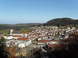 A general view of Maîche | |
.svg.png.webp) Coat of arms | |
Location of Maîche | |
 Maîche  Maîche | |
| Coordinates: 47°15′07″N 6°48′16″E / 47.2519°N 6.8044°E | |
| Country | France |
| Region | Bourgogne-Franche-Comté |
| Department | Doubs |
| Arrondissement | Montbéliard |
| Canton | Maîche |
| Intercommunality | Pays de Maîche |
| Government | |
| • Mayor (2020–2026) | Régis Ligier[1] |
| Area 1 | 17.42 km2 (6.73 sq mi) |
| Population | 4,244 |
| • Density | 240/km2 (630/sq mi) |
| Time zone | UTC+01:00 (CET) |
| • Summer (DST) | UTC+02:00 (CEST) |
| INSEE/Postal code | 25356 /25120 |
| Elevation | 729–981 m (2,392–3,219 ft) |
| 1 French Land Register data, which excludes lakes, ponds, glaciers > 1 km2 (0.386 sq mi or 247 acres) and river estuaries. | |
Maîche (French pronunciation: [mɛʃ]) is a commune in the Doubs department in the Bourgogne-Franche-Comté region in eastern France.
Geography
Maîche is situated between the rivers Doubs and Dessoubre. It is surrounded by evergreen forests. The highest point in the commune is the Faux Verger.
Population
| Year | Pop. | ±% p.a. |
|---|---|---|
| 1968 | 3,714 | — |
| 1975 | 4,381 | +2.39% |
| 1982 | 4,216 | −0.55% |
| 1990 | 4,168 | −0.14% |
| 1999 | 3,978 | −0.52% |
| 2007 | 4,076 | +0.30% |
| 2012 | 4,331 | +1.22% |
| 2017 | 4,286 | −0.21% |
| Source: INSEE[3] | ||
See also
References
- ↑ "Répertoire national des élus: les maires". data.gouv.fr, Plateforme ouverte des données publiques françaises (in French). 2 December 2020.
- ↑ "Populations légales 2021". The National Institute of Statistics and Economic Studies. 28 December 2023.
- ↑ Population en historique depuis 1968, INSEE
External links
Wikimedia Commons has media related to Maîche.
- Official website (in French)
- Maîche on the intercommunal Web site of the department (in French)
This article is issued from Wikipedia. The text is licensed under Creative Commons - Attribution - Sharealike. Additional terms may apply for the media files.