Township of Morrow | |
|---|---|
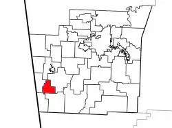 Location of Morrow Township in Washington County | |
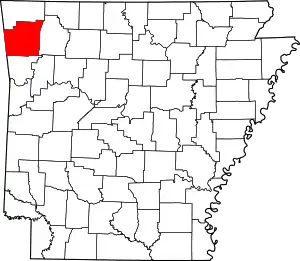 Location of Washington County in Arkansas | |
| Coordinates: 35°52′15″N 94°26′1″W / 35.87083°N 94.43361°W | |
| Country | |
| State | |
| County | Washington |
| Area | |
| • Total | 11.3 sq mi (29 km2) |
| • Land | 11.3 sq mi (29 km2) |
| • Water | 0.0 sq mi (0 km2) 0% |
| Elevation | 1,129 ft (344 m) |
| Population | |
| • Total | 459 |
| • Density | 40/sq mi (20/km2) |
| Time zone | UTC-6 (CST) |
| • Summer (DST) | UTC-5 (CDT) |
| Area code | 479 |
| GNIS feature ID | 69796[1] |
Morrow Township is one of thirty-seven townships in Washington County, Arkansas, USA.[2]
Geography
According to the United States Census Bureau, Morrow Township covers an area of 11.3 square miles (29 km2); all land.[2]
Cities, towns, villages
Cemeteries
The township contains Bethesda Cemetery, Bethlehem Cemetery, Drake Cemetery, Edmiston Cemetery, and English Cemetery.
Major routes
See also
References
- 1 2 U.S. Geological Survey Geographic Names Information System: Morrow Township, Washington County, Arkansas
- 1 2 3 "Township of Morrow, Washington County, Arkansas". U.S. Census Bureau. Retrieved September 16, 2011.
External links
Places adjacent to Morrow Township, Washington County, Arkansas | ||||||||||||||||
|---|---|---|---|---|---|---|---|---|---|---|---|---|---|---|---|---|
| ||||||||||||||||
This article is issued from Wikipedia. The text is licensed under Creative Commons - Attribution - Sharealike. Additional terms may apply for the media files.