Township of Prairie | |
|---|---|
 Location of Prairie Township in Washington County | |
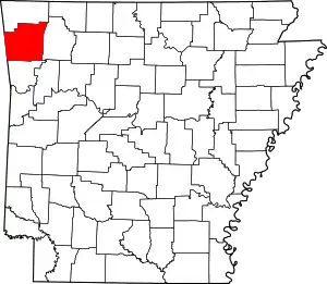 Location of Washington County in Arkansas | |
| Coordinates: 36°5′10″N 94°8′16″W / 36.08611°N 94.13778°W | |
| Country | |
| State | |
| County | Washington |
| Established | 1829[1] |
| Area | |
| • Total | 29.8 sq mi (77 km2) |
| • Land | 29.7 sq mi (77 km2) |
| • Water | 0.1 sq mi (0.3 km2) |
| Elevation | 1,335 ft (407 m) |
| Population (2000) | |
| • Total | 3,526 |
| • Density | 119/sq mi (46/km2) |
| Time zone | UTC-6 (CST) |
| • Summer (DST) | UTC-5 (CDT) |
| Area code | 479 |
| GNIS feature ID | 69797[2] |
Prairie Township is one of 37 townships in Washington County, Arkansas, USA.[3] As of the 2000 census, its total population was 3,526.
Geography
According to the United States Census Bureau, Morrow Township covers an area of 29.8 square miles (77 km2); with 29.7 miles (47.8 km) being land and the remaining 0.1 miles (0.16 km) being water.[3] The township has been fragmented by the expansion of Fayetteville and thus Fayetteville Township. Prairie now consists of two main segments along Fayetteville's eastern edge and three very small segments on Fayetteville's west side.
The township gave part to Reed Township in 1880 and part to Wyman Township between 1890 and 1900.[1]
Cities, towns, villages
Cemeteries
The township contains Hester Cemetery and St. Joseph Cemetery.
Major routes
References
- 1 2 Baker, Russell (1985). Arkansas Township Atlas 1819-1930. Hot Springs, AR: Arkansas Genealogical Society. p. 202. OCLC 11528205.
- 1 2 U.S. Geological Survey Geographic Names Information System: Prairie Township, Washington County, Arkansas
- 1 2 "Township of Prairie, Washington County, Arkansas". U.S. Census Bureau. Retrieved September 20, 2011.
External links
Places adjacent to Prairie Township, Washington County, Arkansas | ||||||||||||||||
|---|---|---|---|---|---|---|---|---|---|---|---|---|---|---|---|---|
| ||||||||||||||||
This article is issued from Wikipedia. The text is licensed under Creative Commons - Attribution - Sharealike. Additional terms may apply for the media files.