Ohnišťany | |
|---|---|
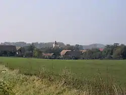 View towards the Church of Saint Wenceslaus | |
 Coat of arms | |
 Ohnišťany Location in the Czech Republic | |
| Coordinates: 50°19′46″N 15°30′40″E / 50.32944°N 15.51111°E | |
| Country | |
| Region | Hradec Králové |
| District | Hradec Králové |
| First mentioned | 1318 |
| Area | |
| • Total | 8.82 km2 (3.41 sq mi) |
| Elevation | 246 m (807 ft) |
| Population (2023-01-01)[1] | |
| • Total | 334 |
| • Density | 38/km2 (98/sq mi) |
| Time zone | UTC+1 (CET) |
| • Summer (DST) | UTC+2 (CEST) |
| Postal code | 503 54 |
| Website | www |
Ohnišťany is a municipality and village in Hradec Králové District in the Hradec Králové Region of the Czech Republic. It has about 300 inhabitants.
References
Wikimedia Commons has media related to Ohnišťany.
This article is issued from Wikipedia. The text is licensed under Creative Commons - Attribution - Sharealike. Additional terms may apply for the media files.