Pülümür District | |
|---|---|
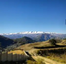 Munzur mountains | |
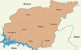 Map showing Pülümür District in Tunceli Province | |
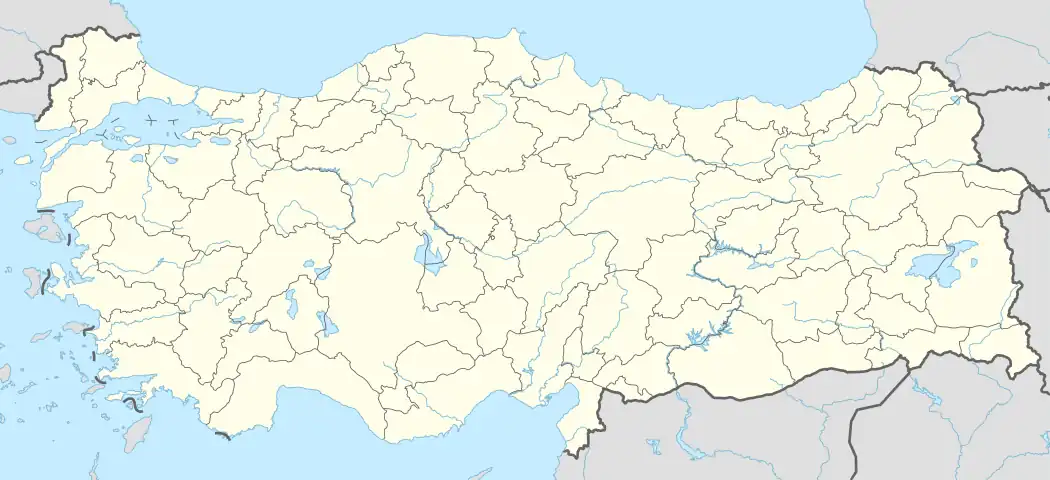 Pülümür District Location in Turkey | |
| Coordinates: 39°28′N 39°59′E / 39.467°N 39.983°E | |
| Country | Turkey |
| Province | Tunceli |
| Seat | Pülümür |
| Area | 1,437 km2 (555 sq mi) |
| Population (2021) | 3,282 |
| • Density | 2.3/km2 (5.9/sq mi) |
| Time zone | TRT (UTC+3) |
| Website | www |
Pülümür District is a district of Tunceli Province in Turkey. The town of Pülümür is its seat and the district had a population of 3,282 in 2021.[1][2] Its area is 1,437 km2.[3]
Composition
Beside the town of Pülümür, the district encompasses forty-nine villages and 267 hamlets.[1]
- Ağaşenliği
- Akdik
- Altınhüseyin
- Ardıçlı
- Bardakçı
- Başkalecik
- Boğalı
- Bozağakaraderbendi
- Çağlayan
- Çakırkaya
- Çobanyıldızı
- Dağbek
- Dağyolu
- Dereboyu
- Dereköy
- Derindere
- Doğanpınar
- Efeağılı
- Elmalı
- Göcenek
- Gökçekonak
- Hacılı
- Hasangazi
- Kabadal
- Kangallı
- Karagöz
- Kayırlar
- Kaymaztepe
- Kırdım
- Kırklar
- Kırkmeşe
- Kızılmescit
- Kocatepe
- Kovuklu
- Közlüce
- Kuzulca
- Mezraa
- Nohutlu
- Sağlamtaş
- Salkımözü
- Sarıgül
- Senek
- Süleymanuşağı
- Şampaşakaraderbendi
- Taşlık
- Turnadere
- Üçdam
- Ünveren
- Yarbaşı
References
- 1 2 "Türkiye Mülki İdare Bölümleri Envanteri". T.C. İçişleri Bakanlığı (in Turkish). Retrieved 19 December 2022.
- ↑ "31 ARALIK 2021 TARİHLİ ADRESE DAYALI NÜFUS KAYIT SİSTEMİ (ADNKS) SONUÇLARI" (XLS). TÜİK (in Turkish). Retrieved 16 December 2022.
- ↑ "İl ve İlçe Yüz ölçümleri". General Directorate of Mapping. Retrieved 1 March 2023.
Pülümür District in Tunceli Province of Turkey | |||||||||||||||||||||||||||
|---|---|---|---|---|---|---|---|---|---|---|---|---|---|---|---|---|---|---|---|---|---|---|---|---|---|---|---|
| Districts | 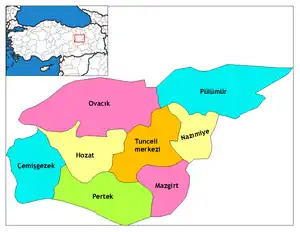 Districts of Tunceli | ||||||||||||||||||||||||||
| |||||||||||||||||||||||||||
Metropolitan municipalities are bolded. | |||||||||||||||||||||||||||
This article is issued from Wikipedia. The text is licensed under Creative Commons - Attribution - Sharealike. Additional terms may apply for the media files.